Earthquake SOUTHERN SUMATRA, INDONESIA
Sat, 17 Jan 2026 14:58:13 GMT
Time1 month ago
Location
-3.3200, 101.6700
Depth
44.0 KM
Event Summary
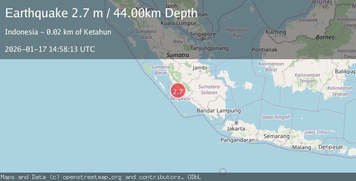
A 2.7 magnitude earthquake struck on SOUTHERN SUMATRA, INDONESIA, at Sat, 17 Jan 2026 14:58:13 GMT. Depth: 44km. Reviewed by BMKG seismologists, this minor quake occurred at a magnitude type of m.
Magnitude
2.7
m
Source
BMKG
Intensity
-
Agency Reports
1 Sources| Source | Magnitude | Depth | Time |
|---|---|---|---|
| BMKGPrimary | 2.7 | 44 km | 1 month ago |
Earthquake Details
AutomaticEvent IDemsc_BMKG_20260117_0000168
Tsunami PotentialNo
Magnitude Typem
Nearest Places
- Karangpulau4.7 km
- Desa Kota Bani7.0 km
- Kecamatan Putri Hijau7.5 km
- Desa Karang Pulau8.3 km
- Desa Air Petai8.6 km
Comments
Join the discussion about this event.
Latest Earthquakes
2.7Mag
near the coast of Tarapaca, Chile
Time13 hours ago
Depth2.08 km
SourceVYT (Automatic)
0.9Mag
17 km S of Little Lake, CA
Time13 hours ago
Depth1.71 km
SourceUSGS (Automatic)
3.4Mag
OKLAHOMA
Time13 hours ago
Depth0.40 km
SourceOK (Automatic)
3.2Mag
Oklahoma
Time13 hours ago
Depth138.92 km
SourceVYT (Automatic)
1.6Mag
Southern Alaska
Time13 hours ago
Depth17.82 km
SourceVYT (Automatic)
Nearby Earthquakes
3.0Mag
SOUTHERN SUMATRA, INDONESIA
Time3 years ago
Depth34.00 km
SourceDJA (Automatic)
3.4Mag
SOUTHERN SUMATRA, INDONESIA
Time1 month ago
Depth46.00 km
SourceBMKG (Automatic)
3.0Mag
SOUTHERN SUMATRA, INDONESIA
Time10 months ago
Depth38.00 km
SourceBMKG (Automatic)
3.0Mag
Southern Sumatra, Indonesia
Time3 days ago
Depth12.56 km
SourceBMKG
2.8Mag
SOUTHERN SUMATRA, INDONESIA
Time1 month ago
Depth34.00 km
SourceBMKG (Automatic)