Earthquake SUMBAWA REGION, INDONESIA
Mon, 19 Jan 2026 13:18:49 GMT
Time1 month ago
Location
-8.2200, 117.7200
Depth
18.0 KM
Event Summary
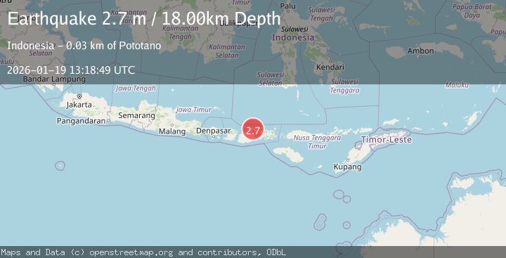
A 2.7 magnitude earthquake struck on SUMBAWA REGION, INDONESIA, at Mon, 19 Jan 2026 13:18:49 GMT. Depth: 18km. Reviewed by BMKG seismologists, this minor quake occurred at a magnitude type of m.
Magnitude
2.7
m
Source
BMKG
Intensity
-
Agency Reports
1 Sources| Source | Magnitude | Depth | Time |
|---|---|---|---|
| BMKGPrimary | 2.7 | 18 km | 1 month ago |
Earthquake Details
AutomaticEvent IDemsc_BMKG_20260119_0000156
Tsunami PotentialNo
Magnitude Typem
Nearest Places
- Desa Calabai0.9 km
- Kampungbaru1.1 km
- Asramapiner1.3 km
- Latonda Satu1.4 km
- Teluk Calabai1.5 km
Comments
Join the discussion about this event.
Latest Earthquakes
2.2Mag
Bali Sea
Time20 hours ago
Depth18.08 km
SourceBMKG
1.9Mag
Central Alaska
Time20 hours ago
Depth100.95 km
SourceVYT (Automatic)
5.4Mag
Java, Indonesia
Time20 hours ago
Depth178.10 km
SourceVYT (Automatic)
2.1Mag
Antofagasta, Chile
Time20 hours ago
Depth0.00 km
SourceVYT (Automatic)
3.1Mag
DODECANESE IS.-TURKEY BORDER REG
Time20 hours ago
Depth17.00 km
SourceTHE (Automatic)
Nearby Earthquakes
2.1Mag
Sumbawa Region, Indonesia
Time4 days ago
Depth27.65 km
SourceBMKG
2.5Mag
Sumbawa Region, Indonesia
Time3 weeks ago
Depth23.91 km
SourceBMKG (Automatic)
2.5Mag
SUMBAWA REGION, INDONESIA
Time1 month ago
Depth11.00 km
SourceBMKG (Automatic)
2.1Mag
Sumbawa Region, Indonesia
Time4 days ago
Depth20.76 km
SourceBMKG
2.2Mag
Sumbawa Region, Indonesia
Time3 days ago
Depth10.00 km
SourceBMKG