Earthquake PHILIPPINE ISLANDS REGION
Tue, 20 Jan 2026 03:53:18 GMT
Time1 month ago
Location
5.1200, 127.4000
Depth
90.0 KM
Event Summary
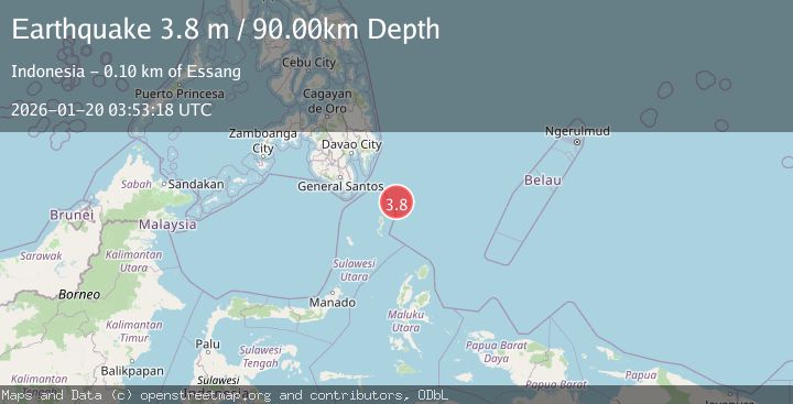
A 3.8 magnitude earthquake struck on PHILIPPINE ISLANDS REGION, at Tue, 20 Jan 2026 03:53:18 GMT. Depth: 90km. Reviewed by BMKG seismologists, this minor quake occurred at a magnitude type of m.
Magnitude
3.8
m
Source
BMKG
Intensity
-
Agency Reports
1 Sources| Source | Magnitude | Depth | Time |
|---|---|---|---|
| BMKGPrimary | 3.8 | 90 km | 1 month ago |
Earthquake Details
AutomaticEvent IDemsc_BMKG_20260120_0000052
Tsunami PotentialNo
Magnitude Typem
Nearest Places
- Desa Marampit Timur49.8 km
- Desa Marampit50.1 km
- Kecamatan Nanusa50.8 km
- Desa Dampulis50.8 km
- Pulau Marampit50.9 km
Comments
Join the discussion about this event.
Latest Earthquakes
1.7Mag
Central Alaska
Time12 hours ago
Depth10.00 km
SourceVYT (Automatic)
1.4Mag
17 km S of Tres Pinos, CA
Time12 hours ago
Depth5.12 km
SourceUSGS (Automatic)
1.8Mag
Southern Alaska
Time12 hours ago
Depth0.00 km
SourceVYT (Automatic)
2.0Mag
Java, Indonesia
Time13 hours ago
Depth5.00 km
SourceBMKG
0.7Mag
2 km SE of Loma Linda, CA
Time13 hours ago
Depth3.87 km
SourceUSGS (Automatic)
Nearby Earthquakes
3.0Mag
PHILIPPINE ISLANDS REGION
Time1 year ago
Depth157.00 km
SourcePIVS (Automatic)
3.0Mag
PHILIPPINE ISLANDS REGION
Time5 months ago
Depth112.00 km
SourceBMKG (Automatic)
3.0Mag
PHILIPPINE ISLANDS REGION
Time1 year ago
Depth9.00 km
SourcePIVS (Automatic)
5.0Mag
PHILIPPINE ISLANDS REGION
Time15 years ago
Depth117.00 km
SourceEMSC (Automatic)
5.3Mag
PHILIPPINE ISLANDS REGION
Time16 years ago
Depth92.00 km
SourceEMSC (Automatic)