Earthquake NEAR N COAST OF PAPUA, INDONESIA
Tue, 20 Jan 2026 07:53:06 GMT
Time0 months ago
Location
-2.5700, 139.2400
Depth
10.0 KM
Event Summary
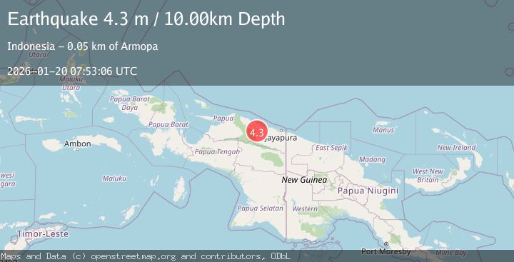
A 4.3 magnitude earthquake struck on NEAR N COAST OF PAPUA, INDONESIA, at Tue, 20 Jan 2026 07:53:06 GMT. Depth: 10km. Reviewed by BMKG seismologists, this light quake occurred at a magnitude type of m.
Magnitude
4.3
m
Source
BMKG
Intensity
-
Agency Reports
1 Sources| Source | Magnitude | Depth | Time |
|---|---|---|---|
| BMKGPrimary | 4.3 | 10 km | 0 months ago |
Earthquake Details
AutomaticEvent IDemsc_BMKG_20260120_0000111
Tsunami PotentialNo
Magnitude Typem
Nearest Places
- Pegunungan Karamoor6.1 km
- Kampung Betaf15.4 km
- Provinsi Papua19.6 km
- Kampung Betaf Dua22.1 km
- Kampung Komra22.9 km
Comments
Join the discussion about this event.
Latest Earthquakes
2.8Mag
West Papua Region, Indonesia
Time4 minutes ago
Depth34.12 km
SourceBMKG
3.6Mag
NORTHERN ALGERIA
Time11 minutes ago
Depth5.80 km
SourceIGN (Automatic)
2.6Mag
Java, Indonesia
Time14 minutes ago
Depth214.22 km
SourceBMKG
1.0Mag
Southeastern Alaska
Time14 minutes ago
Depth0.00 km
SourceVYT (Automatic)
3.5Mag
COOK STRAIT, NEW ZEALAND
Time15 minutes ago
Depth75.30 km
SourceGNS (Automatic)
Nearby Earthquakes
3.4Mag
Near North Coast of West Papua
Time2 weeks ago
Depth10.00 km
SourceBMKG (Automatic)
3.0Mag
NEAR N COAST OF PAPUA, INDONESIA
Time4 years ago
Depth21.00 km
SourceDJA (Automatic)
3.0Mag
NEAR N COAST OF PAPUA, INDONESIA
Time2 years ago
Depth87.00 km
SourceDJA (Automatic)
4.0Mag
NEAR N COAST OF PAPUA, INDONESIA
Time2 years ago
Depth10.00 km
SourceBMKG (Automatic)
3.0Mag
NEAR N COAST OF PAPUA, INDONESIA
Time3 years ago
Depth10.00 km
SourceDJA (Automatic)