Earthquake SOUTH OF BALI, INDONESIA
Tue, 20 Jan 2026 20:53:22 GMT
Time0 months ago
Location
-9.4100, 115.4300
Depth
26.0 KM
Event Summary
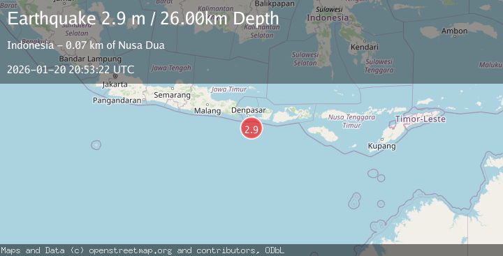
A 2.9 magnitude earthquake struck on SOUTH OF BALI, INDONESIA, at Tue, 20 Jan 2026 20:53:22 GMT. Depth: 26km. Reviewed by BMKG seismologists, this minor quake occurred at a magnitude type of m.
Magnitude
2.9
m
Source
BMKG
Intensity
-
Agency Reports
1 Sources| Source | Magnitude | Depth | Time |
|---|---|---|---|
| BMKGPrimary | 2.9 | 26 km | 0 months ago |
Earthquake Details
AutomaticEvent IDemsc_BMKG_20260120_0000313
Tsunami PotentialNo
Magnitude Typem
Nearest Places
- Bumi Linggah The Pratama Villas63.6 km
- Tanjung Bakung67.9 km
- Tukad Mejan68.2 km
- Nusa Batujinengan68.3 km
- Nusa Batujinengan68.3 km
Comments
Join the discussion about this event.
Latest Earthquakes
1.9Mag
Central Alaska
Time4 minutes ago
Depth7.57 km
SourceVYT (Automatic)
1.5Mag
Central California
Time4 minutes ago
Depth0.00 km
SourceVYT (Automatic)
0.7Mag
Washington
Time5 minutes ago
Depth0.00 km
SourceVYT (Automatic)
2.8Mag
Antofagasta, Chile
Time9 minutes ago
Depth102.66 km
SourceVYT (Automatic)
2.8Mag
Minahassa Peninsula, Sulawesi
Time9 minutes ago
Depth11.18 km
SourceBMKG
Nearby Earthquakes
2.7Mag
South of Bali, Indonesia
Time2 weeks ago
Depth28.04 km
SourceBMKG (Automatic)
2.2Mag
South of Bali, Indonesia
Time4 days ago
Depth15.58 km
SourceBMKG
3.0Mag
SOUTH OF BALI, INDONESIA
Time9 months ago
Depth23.00 km
SourceBMKG (Automatic)
3.0Mag
SOUTH OF BALI, INDONESIA
Time3 years ago
Depth25.00 km
SourceDJA (Automatic)
3.0Mag
SOUTH OF BALI, INDONESIA
Time1 month ago
Depth30.00 km
SourceBMKG (Automatic)