Earthquake SUMBAWA REGION, INDONESIA
Tue, 10 Feb 2026 06:27:14 GMT
Time5 hours ago
Location
-9.6900, 117.6600
Depth
63.0 KM
Event Summary
A 3.0 magnitude earthquake struck on SUMBAWA REGION, INDONESIA, at Tue, 10 Feb 2026 06:27:14 GMT. Depth: 63km. Reviewed by BMKG seismologists, this minor quake occurred at a magnitude type of m.
Magnitude
3.0
m
Source
BMKG
Intensity
-
Agency Reports
1 Sources| Source | Magnitude | Depth | Time |
|---|---|---|---|
| BMKGPrimary | 3.0 | 63 km | 5 hours ago |
Earthquake Details
AutomaticEvent IDemsc_BMKG_20260210_0000092
Tsunami PotentialNo
Magnitude Typem
Nearest Places
- Tanjung Liongsong73.6 km
- Sungai Dodo77.1 km
- Tanjung Lesek77.1 km
- Teluk Sarang78.1 km
- Nanga Sumpee78.3 km
Comments
Join the discussion about this event.
Latest Earthquakes
0.8Mag
4 km WSW of The Geysers, CA
Time5 hours ago
Depth8.91 km
SourceUSGS (Automatic)
3.1Mag
CENTRAL ALASKA
Time5 hours ago
Depth5.40 km
SourceAK (Automatic)
3.4Mag
southern Sumatra, Indonesia
Time5 hours ago
Depth0.12 km
SourceVYT (Automatic)
0.7Mag
15 km ENE of Mammoth Lakes, CA
Time5 hours ago
Depth3.07 km
SourceUSGS (Automatic)
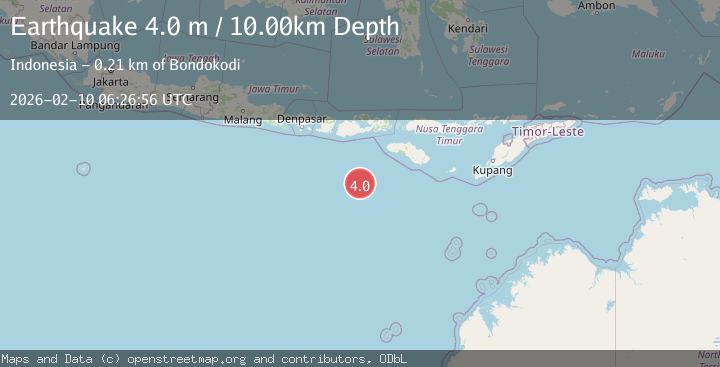
4.0Mag
South of Sumbawa, Indonesia
Time5 hours ago
Depth10.00 km
SourceBMKG
Nearby Earthquakes
2.2Mag
Sumbawa Region, Indonesia
Time20 hours ago
Depth28.51 km
SourceBMKG (Automatic)
2.0Mag
Sumbawa Region, Indonesia
Time1 week ago
Depth23.59 km
SourceBMKG (Automatic)
2.5Mag
Sumbawa Region, Indonesia
Time1 day ago
Depth24.83 km
SourceBMKG (Automatic)
2.8Mag
Sumbawa Region, Indonesia
Time2 weeks ago
Depth72.60 km
SourceBMKG (Automatic)
2.4Mag
Sumbawa Region, Indonesia
Time2 weeks ago
Depth24.27 km
SourceBMKG (Automatic)