Earthquake MORO GULF, MINDANAO, PHILIPPINES
Sun, 30 Jun 2019 01:10:35 GMT
Time6 years ago
Location
6.7200, 123.8500
Depth
10.0 KM
Event Summary
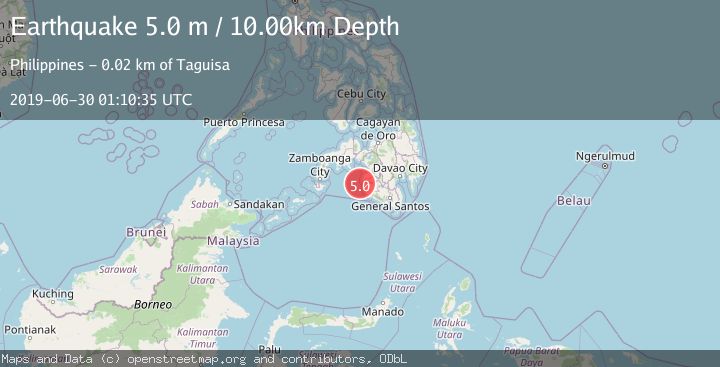
A 5.0 magnitude earthquake struck on MORO GULF, MINDANAO, PHILIPPINES, at Sun, 30 Jun 2019 01:10:35 GMT. Depth: 10km. Reviewed by DJA seismologists, this moderate quake occurred at a magnitude type of m.
Magnitude
5.0
m
Source
DJA
Intensity
-
Agency Reports
1 Sources| Source | Magnitude | Depth | Time |
|---|---|---|---|
| DJAPrimary | 5.0 | 10 km | 6 years ago |
Earthquake Details
AutomaticEvent IDemsc_DJA_20190630_0000004
Tsunami PotentialNo
Magnitude Typem
Nearest Places
- Huidobro Reef11.2 km
- Linao Point14.5 km
- Salpa Point14.9 km
- Ipil Point15.0 km
- Sadam Bay15.1 km
Comments
Join the discussion about this event.
Latest Earthquakes
2.2Mag
OKLAHOMA
Time18 hours ago
Depth3.40 km
SourceOK (Automatic)
1.6Mag
Southern Alaska
Time18 hours ago
Depth48.58 km
SourceVYT (Automatic)
2.2Mag
PUERTO RICO
Time18 hours ago
Depth13.80 km
SourcePR (Automatic)
2.3Mag
Antofagasta, Chile
Time18 hours ago
Depth82.15 km
SourceVYT (Automatic)
2.1Mag
Southern Alaska
Time18 hours ago
Depth64.21 km
SourceVYT (Automatic)
Nearby Earthquakes
5.4Mag
MORO GULF, MINDANAO, PHILIPPINES
Time1 year ago
Depth538.80 km
SourceEMSC (Automatic)
5.2Mag
MORO GULF, MINDANAO, PHILIPPINES
Time18 years ago
Depth570.00 km
SourceEMSC (Automatic)
5.0Mag
MORO GULF, MINDANAO, PHILIPPINES
Time14 years ago
Depth580.00 km
SourceEMSC (Automatic)
3.0Mag
MORO GULF, MINDANAO, PHILIPPINES
Time5 years ago
Depth26.00 km
SourcePIVS (Automatic)
5.0Mag
MORO GULF, MINDANAO, PHILIPPINES
Time13 years ago
Depth10.00 km
SourceEMSC (Automatic)