Earthquake NORTH OF HALMAHERA, INDONESIA
Sat, 22 Aug 2020 02:09:13 GMT
Time5 years ago
Location
3.2600, 128.0100
Depth
152.0 KM
Event Summary
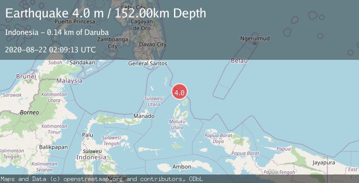
A 4.0 magnitude earthquake struck on NORTH OF HALMAHERA, INDONESIA, at Sat, 22 Aug 2020 02:09:13 GMT. Depth: 152km. Reviewed by DJA seismologists, this light quake occurred at a magnitude type of m.
Magnitude
4.0
m
Source
DJA
Intensity
-
Agency Reports
1 Sources| Source | Magnitude | Depth | Time |
|---|---|---|---|
| DJAPrimary | 4.0 | 152 km | 5 years ago |
Earthquake Details
AutomaticEvent IDemsc_DJA_20200822_0000010
Tsunami PotentialNo
Magnitude Typem
Nearest Places
- Morotai Basin28.9 km
- Pulau Karis56.8 km
- Snellius Ridge82.3 km
- Tanjung Padangi89.6 km
- Tanjung Berri Berri89.7 km
Comments
Join the discussion about this event.
Latest Earthquakes
1.7Mag
northern Alaska
Time2 hours ago
Depth4.64 km
SourceVYT (Automatic)
1.2Mag
5 km WNW of The Geysers, CA
Time2 hours ago
Depth3.19 km
SourceUSGS (Automatic)
3.4Mag
Sulawesi, Indonesia
Time2 hours ago
Depth27.95 km
SourceVYT (Automatic)
1.6Mag
Central Alaska
Time2 hours ago
Depth18.07 km
SourceVYT (Automatic)
2.5Mag
Bering Strait
Time2 hours ago
Depth200.07 km
SourceVYT (Automatic)
Nearby Earthquakes
4.0Mag
NORTH OF HALMAHERA, INDONESIA
Time6 years ago
Depth147.00 km
SourceDJA (Automatic)
4.0Mag
NORTH OF HALMAHERA, INDONESIA
Time2 years ago
Depth29.00 km
SourceBMKG (Automatic)
5.1Mag
Talaud Islands, Indonesia
Time5 days ago
Depth98.59 km
SourceBMKG
4.0Mag
NORTH OF HALMAHERA, INDONESIA
Time7 years ago
Depth22.00 km
SourceDJA (Automatic)
3.4Mag
NORTH OF HALMAHERA, INDONESIA
Time1 month ago
Depth10.00 km
SourceBMKG (Automatic)