Earthquake MOLUCCA SEA
Mon, 22 Feb 2021 08:13:10 GMT
Time4 years ago
Location
2.4200, 127.5400
Depth
32.0 KM
Event Summary
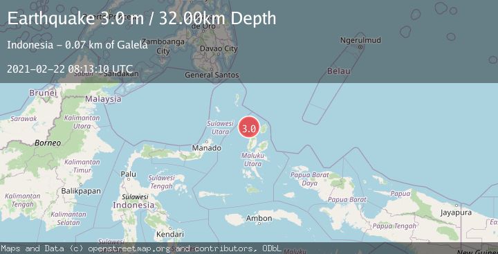
A 3.0 magnitude earthquake struck on MOLUCCA SEA, at Mon, 22 Feb 2021 08:13:10 GMT. Depth: 32km. Reviewed by DJA seismologists, this minor quake occurred at a magnitude type of m.
Magnitude
3.0
m
Source
DJA
Intensity
-
Agency Reports
1 Sources| Source | Magnitude | Depth | Time |
|---|---|---|---|
| DJAPrimary | 3.0 | 32 km | 4 years ago |
Earthquake Details
AutomaticEvent IDemsc_DJA_20210222_0000042
Tsunami PotentialNo
Magnitude Typem
Nearest Places
- Pulau Deherete27.7 km
- Pulau Sedeng29.7 km
- Desa Cera30.5 km
- Pulau Laba30.7 km
- Pulau Takurumagula31.9 km
Comments
Join the discussion about this event.
Latest Earthquakes
1.4Mag
4 km W of Lake Henshaw, CA
Time18 hours ago
Depth12.37 km
SourceUSGS (Automatic)
1.6Mag
41 km NW of Toyah, Texas
Time18 hours ago
Depth3.46 km
SourceUSGS (Automatic)
0.7Mag
6 km WNW of Cobb, CA
Time18 hours ago
Depth-0.59 km
SourceUSGS (Automatic)
1.0Mag
Southern Alaska
Time18 hours ago
Depth0.12 km
SourceVYT (Automatic)
2.1Mag
Sumbawa Region, Indonesia
Time18 hours ago
Depth21.86 km
SourceBMKG
Nearby Earthquakes
3.0Mag
MOLUCCA SEA
Time5 years ago
Depth24.00 km
SourceDJA (Automatic)
5.2Mag
MOLUCCA SEA
Time6 years ago
Depth80.00 km
SourceEMSC (Automatic)
3.0Mag
Northern Molucca Sea
Time3 weeks ago
Depth100.85 km
SourceBMKG (Automatic)
3.0Mag
MOLUCCA SEA
Time4 months ago
Depth50.00 km
SourceBMKG (Automatic)
5.1Mag
MOLUCCA SEA
Time4 years ago
Depth80.00 km
SourceEMSC (Automatic)