Earthquake MORO GULF, MINDANAO, PHILIPPINES
Sun, 19 Dec 2004 15:13:49 GMT
Time21 years ago
Location
6.4200, 123.8800
Depth
33.0 KM
Event Summary
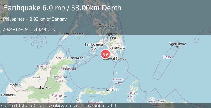
A 6.0 magnitude earthquake struck on MORO GULF, MINDANAO, PHILIPPINES, at Sun, 19 Dec 2004 15:13:49 GMT. Depth: 33km. Reviewed by EMSC seismologists, this strong quake occurred at a magnitude type of mb.
Magnitude
6.0
mb
Source
EMSC
Intensity
-
Agency Reports
1 Sources| Source | Magnitude | Depth | Time |
|---|---|---|---|
| EMSCPrimary | 6.0 | 33 km | 21 years ago |
Earthquake Details
AutomaticEvent IDemsc_EMSC_20041219_0000020
Tsunami PotentialNo
Magnitude Typemb
Nearest Places
- Donauang Island16.4 km
- Donaung Shoals16.6 km
- Danawan Point17.2 km
- Basiauang Bay17.3 km
- Sangay Point17.3 km
Comments
Join the discussion about this event.
Latest Earthquakes
1.3Mag
17 km WSW of Johannesburg, CA
Time4 minutes ago
Depth9.21 km
SourceUSGS (Automatic)
2.0Mag
Flores Region, Indonesia
Time7 minutes ago
Depth27.22 km
SourceBMKG
1.4Mag
31 km WSW of Ackerly, Texas
Time9 minutes ago
Depth9.49 km
SourceUSGS (Automatic)
2.0Mag
Poland
Time13 minutes ago
Depth0.00 km
SourceVYT (Automatic)
2.6Mag
Java, Indonesia
Time15 minutes ago
Depth31.33 km
SourceBMKG
Nearby Earthquakes
3.0Mag
MORO GULF, MINDANAO, PHILIPPINES
Time3 weeks ago
Depth19.00 km
SourcePIVS (Automatic)
4.8Mag
23 km WSW of Sangay, Philippines
Time0 months ago
Depth10.00 km
SourceUSGS
4.7Mag
MORO GULF, MINDANAO, PHILIPPINES
Time1 month ago
Depth6.80 km
SourceEMSC (Automatic)
3.0Mag
MORO GULF, MINDANAO, PHILIPPINES
Time4 years ago
Depth1.00 km
SourcePIVS (Automatic)
3.2Mag
MORO GULF, MINDANAO, PHILIPPINES
Time0 months ago
Depth14.00 km
SourcePIVS (Automatic)