Earthquake MORO GULF, MINDANAO, PHILIPPINES
Tue, 20 Jan 2026 10:29:54 GMT
Time1 month ago
Location
6.4226, 123.8178
Depth
6.8 KM
Event Summary
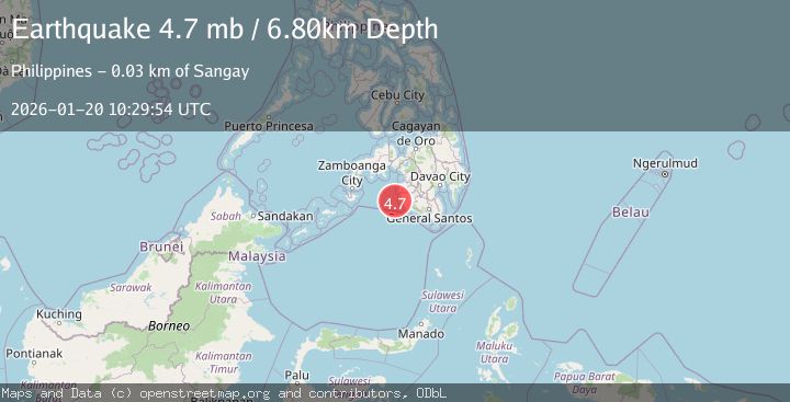
A 4.7 magnitude earthquake struck on MORO GULF, MINDANAO, PHILIPPINES, at Tue, 20 Jan 2026 10:29:54 GMT. Depth: 6.8km. Reviewed by EMSC seismologists, this light quake occurred at a magnitude type of mb.
Magnitude
4.7
mb
Source
EMSC
Intensity
-
Agency Reports
1 Sources| Source | Magnitude | Depth | Time |
|---|---|---|---|
| EMSCPrimary | 4.7 | 7 km | 1 month ago |
Earthquake Details
AutomaticEvent IDemsc_EMSC_20260120_0000156
Tsunami PotentialNo
Magnitude Typemb
Nearest Places
- Donaung Shoals21.8 km
- Donauang Island23.0 km
- Basiauang Bay23.8 km
- Danawan Point23.8 km
- Sangay Point24.2 km
Comments
Join the discussion about this event.
Latest Earthquakes
4.6Mag
Mindanao, Philippines
Time3 hours ago
Depth62.27 km
SourceBMKG
2.9Mag
offshore Coquimbo, Chile
Time3 hours ago
Depth80.08 km
SourceVYT (Automatic)
2.4Mag
Central Alaska
Time3 hours ago
Depth328.98 km
SourceVYT (Automatic)
2.0Mag
FRANCE
Time3 hours ago
Depth9.60 km
SourceReNaSS (Automatic)
3.3Mag
Banda Sea
Time3 hours ago
Depth176.55 km
SourceBMKG
Nearby Earthquakes
3.0Mag
MORO GULF, MINDANAO, PHILIPPINES
Time4 years ago
Depth1.00 km
SourcePIVS (Automatic)
3.0Mag
MORO GULF, MINDANAO, PHILIPPINES
Time3 weeks ago
Depth19.00 km
SourcePIVS (Automatic)
3.9Mag
MORO GULF, MINDANAO, PHILIPPINES
Time2 weeks ago
Depth6.00 km
SourcePIVS (Automatic)
3.0Mag
MORO GULF, MINDANAO, PHILIPPINES
Time3 weeks ago
Depth23.00 km
SourcePIVS (Automatic)
4.7Mag
MORO GULF, MINDANAO, PHILIPPINES
Time3 weeks ago
Depth35.00 km
SourceEMSC (Automatic)