Earthquake 23 km WSW of Sangay, Philippines
Tue, 20 Jan 2026 23:25:17 GMT
Time6 days ago
Location
6.3780, 123.8398
Depth
10.0 KM
Event Summary
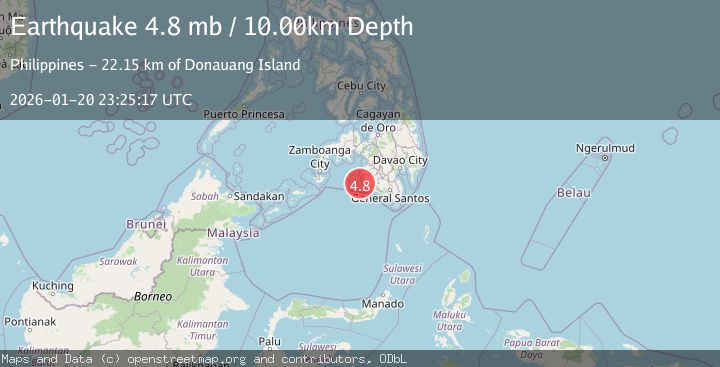
A 4.8 magnitude earthquake struck on 23 km WSW of Sangay, Philippines, at Tue, 20 Jan 2026 23:25:17 GMT. Depth: 10km. Reviewed by USGS seismologists, this light quake occurred at a magnitude type of mb.
Magnitude
4.8
mb
Source
USGS
Intensity
-
Agency Reports
1 Sources| Source | Magnitude | Depth | Time |
|---|---|---|---|
| USGSPrimary | 4.8 | 10 km | 6 days ago |
Earthquake Details
ConfirmedEvent IDusgs_us7000rqzk
Tsunami PotentialNo
Magnitude Typemb
Nearest Places
- Donauang Island22.1 km
- Sangay Point22.4 km
- Danawan Point22.9 km
- Donaung Shoals23.0 km
- Sugco23.1 km
Comments
Join the discussion about this event.
Latest Earthquakes
2.3Mag
Flores Sea
Time16 hours ago
Depth21.75 km
SourceBMKG (Automatic)
2.2Mag
NEVADA
Time16 hours ago
Depth8.30 km
SourceNN (Automatic)
1.8Mag
13 km SSE of Volcano, Hawaii
Time16 hours ago
Depth3.46 km
SourceUSGS (Automatic)
1.4Mag
10 km N of Hollister, CA
Time16 hours ago
Depth10.13 km
SourceUSGS (Automatic)
1.2Mag
13 km WSW of Stanton, Texas
Time16 hours ago
Depth3.46 km
SourceUSGS (Automatic)
Nearby Earthquakes
5.4Mag
32 km WSW of Sangay, Philippines
Time6 days ago
Depth8.76 km
SourceUSGS
3.0Mag
MORO GULF, MINDANAO, PHILIPPINES
Time1 day ago
Depth23.00 km
SourcePIVS (Automatic)
3.1Mag
MORO GULF, MINDANAO, PHILIPPINES
Time4 days ago
Depth20.00 km
SourcePIVS (Automatic)
3.2Mag
MORO GULF, MINDANAO, PHILIPPINES
Time5 days ago
Depth1.00 km
SourcePIVS (Automatic)
4.2Mag
MORO GULF, MINDANAO, PHILIPPINES
Time6 days ago
Depth10.00 km
SourcePIVS (Automatic)