Earthquake KERMADEC ISLANDS REGION
Mon, 14 Aug 2006 23:04:13 GMT
Time19 years ago
Location
-31.6000, 179.6900
Depth
400.0 KM
Event Summary
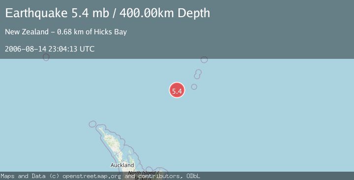
A 5.4 magnitude earthquake struck on KERMADEC ISLANDS REGION, at Mon, 14 Aug 2006 23:04:13 GMT. Depth: 400km. Reviewed by EMSC seismologists, this moderate quake occurred at a magnitude type of mb.
Magnitude
5.4
mb
Source
EMSC
Intensity
-
Agency Reports
1 Sources| Source | Magnitude | Depth | Time |
|---|---|---|---|
| EMSCPrimary | 5.4 | 400 km | 19 years ago |
Earthquake Details
AutomaticEvent IDemsc_EMSC_20060814_0000057
Tsunami PotentialNo
Magnitude Typemb
Nearest Places
- Havre Trough77.6 km
- Oliver Knoll106.9 km
- Speight Knoll110.8 km
- Havre Rock127.3 km
- Haungaroa Seamount130.1 km
Comments
Join the discussion about this event.
Latest Earthquakes
4.5Mag
Tarapaca, Chile
Time4 minutes ago
Depth128.42 km
SourceVYT (Automatic)
1.5Mag
4 km NE of Muscoy, CA
Time10 minutes ago
Depth7.69 km
SourceUSGS (Automatic)
0.8Mag
6 km W of Cobb, CA
Time11 minutes ago
Depth0.90 km
SourceUSGS (Automatic)
1.4Mag
Southern Alaska
Time16 minutes ago
Depth70.19 km
SourceVYT (Automatic)
1.3Mag
14 km SW of Toms Place, CA
Time16 minutes ago
Depth5.49 km
SourceUSGS (Automatic)
Nearby Earthquakes
6.1Mag
KERMADEC ISLANDS REGION
Time16 years ago
Depth440.00 km
SourceEMSC (Automatic)
5.4Mag
KERMADEC ISLANDS REGION
Time18 years ago
Depth370.00 km
SourceEMSC (Automatic)
5.0Mag
KERMADEC ISLANDS REGION
Time5 years ago
Depth425.00 km
SourceEMSC (Automatic)
4.0Mag
KERMADEC ISLANDS REGION
Time5 years ago
Depth476.00 km
SourceGNS (Automatic)
3.4Mag
KERMADEC ISLANDS REGION
Time2 hours ago
Depth407.90 km
SourceGNS (Automatic)