Earthquake MOLUCCA SEA
Tue, 16 Jan 2007 18:06:16 GMT
Time19 years ago
Location
2.6700, 126.2900
Depth
60.0 KM
Event Summary
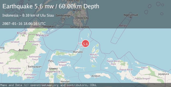
A 5.6 magnitude earthquake struck on MOLUCCA SEA, at Tue, 16 Jan 2007 18:06:16 GMT. Depth: 60km. Reviewed by EMSC seismologists, this moderate quake occurred at a magnitude type of mw.
Magnitude
5.6
mw
Source
EMSC
Intensity
-
Agency Reports
1 Sources| Source | Magnitude | Depth | Time |
|---|---|---|---|
| EMSCPrimary | 5.6 | 60 km | 19 years ago |
Earthquake Details
AutomaticEvent IDemsc_EMSC_20070116_0000068
Tsunami PotentialNo
Magnitude Typemw
Nearest Places
- Pulau Batupuntieng80.3 km
- Pulau Batukemba80.7 km
- Pulau Batuluha80.8 km
- Pulau Nenung81.0 km
- Pulau Batupaliaheng81.2 km
Comments
Join the discussion about this event.
Latest Earthquakes
4.2Mag
Fox Islands, Aleutian Islands, Alaska
Time6 minutes ago
Depth0.00 km
SourceVYT (Automatic)
1.8Mag
Sweden
Time6 minutes ago
Depth0.00 km
SourceVYT (Automatic)
2.0Mag
Bali Region, Indonesia
Time7 minutes ago
Depth73.97 km
SourceBMKG
2.5Mag
Java, Indonesia
Time8 minutes ago
Depth38.78 km
SourceBMKG
2.4Mag
Poland
Time8 minutes ago
Depth2.81 km
SourceVYT (Automatic)
Nearby Earthquakes
3.0Mag
MOLUCCA SEA
Time2 months ago
Depth16.00 km
SourceBMKG (Automatic)
5.5Mag
MOLUCCA SEA
Time15 years ago
Depth70.00 km
SourceEMSC (Automatic)
3.0Mag
MOLUCCA SEA
Time1 month ago
Depth20.00 km
SourceBMKG (Automatic)
3.1Mag
Northern Molucca Sea
Time3 weeks ago
Depth61.58 km
SourceBMKG (Automatic)
3.0Mag
Northern Molucca Sea
Time2 weeks ago
Depth7.40 km
SourceBMKG (Automatic)