Earthquake Bali Region, Indonesia
Thu, 19 Feb 2026 15:13:43 GMT
Time1 hour ago
Location
-8.5562, 115.6860
Depth
74.0 KM
Event Summary
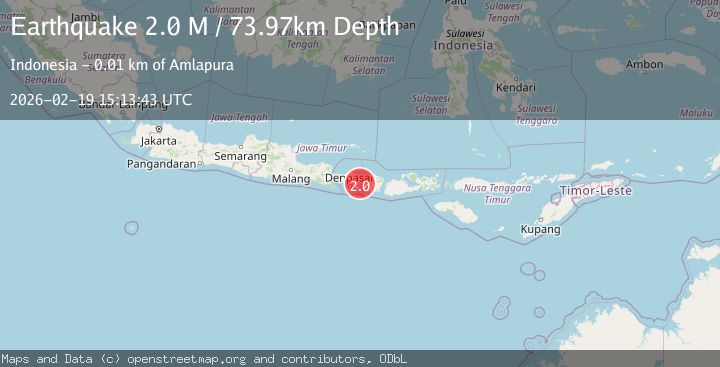
A 2.0 magnitude earthquake struck on Bali Region, Indonesia, at Thu, 19 Feb 2026 15:13:43 GMT. Depth: 73.971466km. Reviewed by BMKG seismologists, this minor quake occurred at a magnitude type of M.
Magnitude
2.0
M
Source
BMKG
Intensity
-
Agency Reports
1 Sources| Source | Magnitude | Depth | Time |
|---|---|---|---|
| BMKGPrimary | 2.0 | 74 km | 1 hour ago |
Earthquake Details
ManualEvent IDbmg2026dmru
Tsunami PotentialNo
Magnitude TypeM
Nearest Places
- Gilimatra7.7 km
- Pulau Kuan9.5 km
- Tanjung Mulu9.9 km
- Tukad Sungga10.7 km
- Tukad Pedih11.0 km
Comments
Join the discussion about this event.
Latest Earthquakes
4.2Mag
Fox Islands, Aleutian Islands, Alaska
Time1 hour ago
Depth0.00 km
SourceVYT (Automatic)
1.8Mag
Sweden
Time1 hour ago
Depth0.00 km
SourceVYT (Automatic)
2.5Mag
Java, Indonesia
Time1 hour ago
Depth38.78 km
SourceBMKG
2.4Mag
Poland
Time1 hour ago
Depth2.81 km
SourceVYT (Automatic)
2.9Mag
Southwest of Sumatra, Indonesia
Time1 hour ago
Depth10.00 km
SourceBMKG
Nearby Earthquakes
2.5Mag
BALI REGION, INDONESIA
Time1 month ago
Depth35.00 km
SourceBMKG (Automatic)
2.6Mag
BALI REGION, INDONESIA
Time1 month ago
Depth43.00 km
SourceBMKG (Automatic)
3.5Mag
Bali Region, Indonesia
Time2 weeks ago
Depth8.96 km
SourceBMKG (Automatic)
3.0Mag
BALI REGION, INDONESIA
Time3 years ago
Depth10.00 km
SourceDJA (Automatic)
2.7Mag
BALI REGION, INDONESIA
Time1 month ago
Depth38.00 km
SourceBMKG (Automatic)