Earthquake SOUTHERN SUMATRA, INDONESIA
Wed, 12 Sep 2007 11:10:21 GMT
Time18 years ago
Location
-4.4000, 101.3600
Depth
10.0 KM
Event Summary
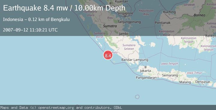
A 8.4 magnitude earthquake struck on SOUTHERN SUMATRA, INDONESIA, at Wed, 12 Sep 2007 11:10:21 GMT. Depth: 10km. Reviewed by EMSC seismologists, this major quake occurred at a magnitude type of mw.
Magnitude
8.4
mw
Source
EMSC
Intensity
-
Agency Reports
1 Sources| Source | Magnitude | Depth | Time |
|---|---|---|---|
| EMSCPrimary | 8.4 | 10 km | 18 years ago |
Earthquake Details
AutomaticEvent IDemsc_EMSC_20070912_0000070
Tsunami PotentialNo
Magnitude Typemw
Nearest Places
- Mentawai Trough47.1 km
- Pulau Mega57.4 km
- Lebar Reef105.7 km
- Pulau Tikus109.6 km
- Ujung Teluk Punggur114.6 km
Comments
Join the discussion about this event.
Latest Earthquakes
2.4Mag
Antofagasta, Chile
Time2 minutes ago
Depth0.00 km
SourceVYT (Automatic)
2.2Mag
Sumbawa Region, Indonesia
Time9 minutes ago
Depth125.89 km
SourceBMKG
1.0Mag
8 km WNW of The Geysers, CA
Time11 minutes ago
Depth0.69 km
SourceUSGS (Automatic)
2.3Mag
SAN FRANCISCO BAY AREA, CALIF.
Time14 minutes ago
Depth8.70 km
SourceNC (Automatic)
2.1Mag
WESTERN TEXAS
Time16 minutes ago
Depth0.00 km
SourceTX (Automatic)
Nearby Earthquakes
5.9Mag
SOUTHERN SUMATRA, INDONESIA
Time6 years ago
Depth10.00 km
SourceEMSC (Automatic)
5.3Mag
SOUTHERN SUMATRA, INDONESIA
Time17 years ago
Depth55.00 km
SourceEMSC (Automatic)
6.4Mag
SOUTHERN SUMATRA, INDONESIA
Time17 years ago
Depth10.00 km
SourceEMSC (Automatic)
5.7Mag
SOUTHERN SUMATRA, INDONESIA
Time17 years ago
Depth29.00 km
SourceEMSC (Automatic)
5.7Mag
SOUTHERN SUMATRA, INDONESIA
Time15 years ago
Depth25.00 km
SourceEMSC (Automatic)