Earthquake SOUTHERN SUMATRA, INDONESIA
Sun, 02 Jan 2011 15:19:31 GMT
Time15 years ago
Location
-4.5200, 101.3600
Depth
25.0 KM
Event Summary
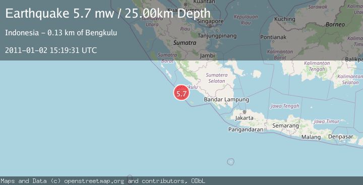
A 5.7 magnitude earthquake struck on SOUTHERN SUMATRA, INDONESIA, at Sun, 02 Jan 2011 15:19:31 GMT. Depth: 25km. Reviewed by EMSC seismologists, this moderate quake occurred at a magnitude type of mw.
Magnitude
5.7
mw
Source
EMSC
Intensity
-
Agency Reports
1 Sources| Source | Magnitude | Depth | Time |
|---|---|---|---|
| EMSCPrimary | 5.7 | 25 km | 15 years ago |
Earthquake Details
AutomaticEvent IDemsc_EMSC_20110102_0000029
Tsunami PotentialNo
Magnitude Typemw
Nearest Places
- Mentawai Trough59.9 km
- Pulau Mega68.2 km
- Lebar Reef112.7 km
- Pulau Tikus117.8 km
- Kelurahan Teluk Sepang121.5 km
Comments
Join the discussion about this event.
Latest Earthquakes
2.4Mag
Antofagasta, Chile
Time2 minutes ago
Depth0.00 km
SourceVYT (Automatic)
2.2Mag
Sumbawa Region, Indonesia
Time9 minutes ago
Depth125.89 km
SourceBMKG
1.0Mag
8 km WNW of The Geysers, CA
Time11 minutes ago
Depth0.69 km
SourceUSGS (Automatic)
2.3Mag
SAN FRANCISCO BAY AREA, CALIF.
Time14 minutes ago
Depth8.70 km
SourceNC (Automatic)
2.1Mag
WESTERN TEXAS
Time16 minutes ago
Depth0.00 km
SourceTX (Automatic)
Nearby Earthquakes
5.4Mag
SOUTHERN SUMATRA, INDONESIA
Time15 years ago
Depth27.00 km
SourceEMSC (Automatic)
5.7Mag
SOUTHERN SUMATRA, INDONESIA
Time17 years ago
Depth29.00 km
SourceEMSC (Automatic)
5.9Mag
SOUTHERN SUMATRA, INDONESIA
Time6 years ago
Depth10.00 km
SourceEMSC (Automatic)
8.4Mag
SOUTHERN SUMATRA, INDONESIA
Time18 years ago
Depth10.00 km
SourceEMSC (Automatic)
6.4Mag
SOUTHERN SUMATRA, INDONESIA
Time17 years ago
Depth10.00 km
SourceEMSC (Automatic)