Earthquake SOUTHERN SUMATRA, INDONESIA
Fri, 14 Sep 2007 03:07:13 GMT
Time18 years ago
Location
-2.8900, 101.1100
Depth
40.0 KM
Event Summary
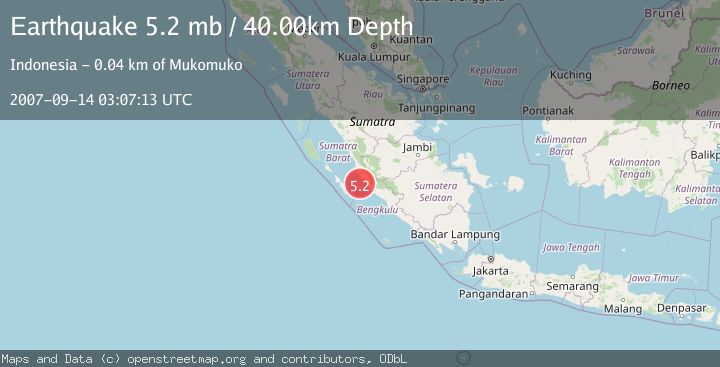
A 5.2 magnitude earthquake struck on SOUTHERN SUMATRA, INDONESIA, at Fri, 14 Sep 2007 03:07:13 GMT. Depth: 40km. Reviewed by EMSC seismologists, this moderate quake occurred at a magnitude type of mb.
Magnitude
5.2
mb
Source
EMSC
Intensity
-
Agency Reports
1 Sources| Source | Magnitude | Depth | Time |
|---|---|---|---|
| EMSCPrimary | 5.2 | 40 km | 18 years ago |
Earthquake Details
AutomaticEvent IDemsc_EMSC_20070914_0000061
Tsunami PotentialNo
Magnitude Typemb
Nearest Places
- Air Dikit27.7 km
- Sungai Pelakan27.7 km
- Air Pelatun Gedang28.1 km
- Airdikit28.2 km
- Pondoklintang28.5 km
Comments
Join the discussion about this event.
Latest Earthquakes
1.7Mag
British Columbia, Canada
Time4 minutes ago
Depth15.99 km
SourceVYT (Automatic)
1.7Mag
7 km SSE of Pāhala, Hawaii
Time5 minutes ago
Depth43.23 km
SourceUSGS (Automatic)
1.6Mag
36 km NNW of Mentone, Texas
Time8 minutes ago
Depth7.26 km
SourceUSGS (Automatic)
2.8Mag
South Australia
Time8 minutes ago
Depth10.00 km
SourceVYT (Automatic)
2.4Mag
Finland-Russia border region
Time8 minutes ago
Depth0.00 km
SourceVYT (Automatic)
Nearby Earthquakes
5.0Mag
SOUTHERN SUMATRA, INDONESIA
Time18 years ago
Depth46.00 km
SourceEMSC (Automatic)
4.2Mag
SOUTHERN SUMATRA, INDONESIA
Time1 month ago
Depth22.00 km
SourceBMKG (Automatic)
2.8Mag
SOUTHERN SUMATRA, INDONESIA
Time1 month ago
Depth26.00 km
SourceBMKG (Automatic)
3.0Mag
SOUTHERN SUMATRA, INDONESIA
Time3 years ago
Depth20.00 km
SourceDJA (Automatic)
5.6Mag
SOUTHERN SUMATRA, INDONESIA
Time6 years ago
Depth30.00 km
SourceEMSC (Automatic)