Earthquake SOUTHERN SUMATRA, INDONESIA
Mon, 16 Dec 2019 14:49:15 GMT
Time6 years ago
Location
-2.9500, 101.0300
Depth
30.0 KM
Event Summary
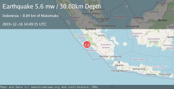
A 5.6 magnitude earthquake struck on SOUTHERN SUMATRA, INDONESIA, at Mon, 16 Dec 2019 14:49:15 GMT. Depth: 30km. Reviewed by EMSC seismologists, this moderate quake occurred at a magnitude type of mw.
Magnitude
5.6
mw
Source
EMSC
Intensity
-
Agency Reports
1 Sources| Source | Magnitude | Depth | Time |
|---|---|---|---|
| EMSCPrimary | 5.6 | 30 km | 6 years ago |
Earthquake Details
AutomaticEvent IDemsc_EMSC_20191216_0000112
Tsunami PotentialNo
Magnitude Typemw
Nearest Places
- Sungai Pelakan37.9 km
- Air Dikit38.1 km
- Airdikit38.6 km
- Kelurahan Koto Jaya38.7 km
- Air Pelatun Gedang38.8 km
Comments
Join the discussion about this event.
Latest Earthquakes
3.1Mag
Timor Sea
Time3 minutes ago
Depth92.16 km
SourceVYT (Automatic)
2.5Mag
Timor Region
Time11 minutes ago
Depth11.14 km
SourceBMKG
1.2Mag
2 km N of Loma Linda, CA
Time12 minutes ago
Depth11.22 km
SourceUSGS (Automatic)
3.2Mag
Alaska Peninsula
Time12 minutes ago
Depth10.00 km
SourceVYT (Automatic)
4.3Mag
Southwest of Sumatra, Indonesia
Time16 minutes ago
Depth11.58 km
SourceBMKG
Nearby Earthquakes
5.0Mag
SOUTHERN SUMATRA, INDONESIA
Time16 years ago
Depth47.00 km
SourceNEIC (Automatic)
5.0Mag
KEP. MENTAWAI REGION, INDONESIA
Time13 years ago
Depth42.00 km
SourceEMSC (Automatic)
4.0Mag
KEP. MENTAWAI REGION, INDONESIA
Time6 years ago
Depth13.00 km
SourceDJA (Automatic)
2.8Mag
SOUTHERN SUMATRA, INDONESIA
Time1 month ago
Depth26.00 km
SourceBMKG (Automatic)
3.7Mag
Southern Sumatra, Indonesia
Time2 weeks ago
Depth12.10 km
SourceBMKG (Automatic)