Earthquake SOUTHWEST OF SUMATRA, INDONESIA
Wed, 17 Dec 2008 16:06:58 GMT
Time17 years ago
Location
-6.0900, 103.4200
Depth
35.0 KM
Event Summary
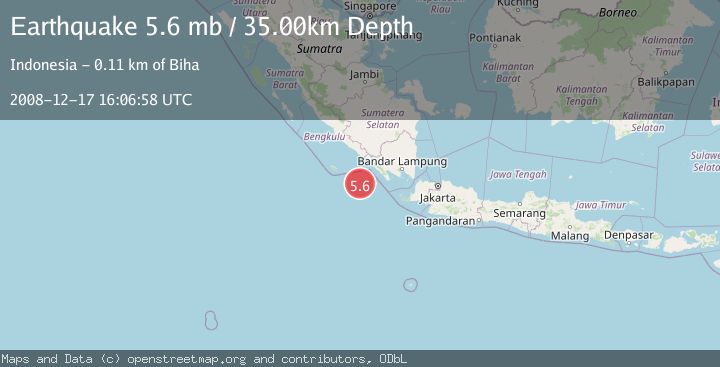
A 5.6 magnitude earthquake struck on SOUTHWEST OF SUMATRA, INDONESIA, at Wed, 17 Dec 2008 16:06:58 GMT. Depth: 35km. Reviewed by EMSC seismologists, this moderate quake occurred at a magnitude type of mb.
Magnitude
5.6
mb
Source
EMSC
Intensity
-
Agency Reports
1 Sources| Source | Magnitude | Depth | Time |
|---|---|---|---|
| EMSCPrimary | 5.6 | 35 km | 17 years ago |
Earthquake Details
AutomaticEvent IDemsc_EMSC_20081217_0000071
Tsunami PotentialNo
Magnitude Typemb
Nearest Places
- Enggano Basin37.8 km
- Wai Tembuli104.7 km
- Wai Ngambur105.1 km
- Desa Muara Tembulih105.4 km
- Wai Marang106.0 km
Comments
Join the discussion about this event.
Latest Earthquakes
4.5Mag
Central Alaska
Time1 minute ago
Depth7.81 km
SourceVYT (Automatic)
1.9Mag
1 km SSW of Pāhala, Hawaii
Time5 minutes ago
Depth28.47 km
SourceUSGS (Automatic)
1.5Mag
5 km NW of The Geysers, CA
Time6 minutes ago
Depth2.47 km
SourceUSGS (Automatic)
0.3Mag
10 km WNW of The Geysers, CA
Time8 minutes ago
Depth2.50 km
SourceUSGS (Automatic)
2.5Mag
Central Alaska
Time10 minutes ago
Depth112.55 km
SourceVYT (Automatic)
Nearby Earthquakes
3.2Mag
Southwest of Sumatra, Indonesia
Time2 weeks ago
Depth26.83 km
SourceBMKG (Automatic)
5.0Mag
SOUTHWEST OF SUMATRA, INDONESIA
Time13 years ago
Depth10.00 km
SourceEMSC (Automatic)
3.0Mag
SOUTHWEST OF SUMATRA, INDONESIA
Time5 years ago
Depth10.00 km
SourceDJA (Automatic)
5.2Mag
SOUTHWEST OF SUMATRA, INDONESIA
Time10 years ago
Depth60.00 km
SourceEMSC (Automatic)
5.2Mag
SOUTHWEST OF SUMATRA, INDONESIA
Time20 years ago
Depth33.00 km
SourceEMSC (Automatic)