Earthquake KEPULAUAN TALAUD, INDONESIA
Fri, 13 Feb 2009 07:56:10 GMT
Time17 years ago
Location
3.7500, 126.8300
Depth
60.0 KM
Event Summary
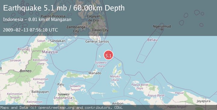
A 5.1 magnitude earthquake struck on KEPULAUAN TALAUD, INDONESIA, at Fri, 13 Feb 2009 07:56:10 GMT. Depth: 60km. Reviewed by EMSC seismologists, this moderate quake occurred at a magnitude type of mb.
Magnitude
5.1
mb
Source
EMSC
Intensity
-
Agency Reports
1 Sources| Source | Magnitude | Depth | Time |
|---|---|---|---|
| EMSCPrimary | 5.1 | 60 km | 17 years ago |
Earthquake Details
AutomaticEvent IDemsc_EMSC_20090213_0000059
Tsunami PotentialNo
Magnitude Typemb
Nearest Places
- Damau0.9 km
- Desa Damau1.4 km
- Desa Damau Bowone1.5 km
- Tanjung Tatimbalangan1.6 km
- Desa Taduwale1.9 km
Comments
Join the discussion about this event.
Latest Earthquakes
0.8Mag
8 km NW of The Geysers, CA
Time3 minutes ago
Depth1.52 km
SourceUSGS (Automatic)
3.9Mag
Coquimbo, Chile
Time7 minutes ago
Depth26.98 km
SourceVYT (Automatic)
2.7Mag
near the coast of Tarapaca, Chile
Time16 minutes ago
Depth56.52 km
SourceVYT (Automatic)
3.8Mag
Molucca Sea
Time17 minutes ago
Depth47.00 km
SourceVYT (Automatic)
1.7Mag
4 km SE of San Ramon, CA
Time17 minutes ago
Depth7.10 km
SourceUSGS (Automatic)
Nearby Earthquakes
5.0Mag
KEPULAUAN TALAUD, INDONESIA
Time19 years ago
Depth60.00 km
SourceEMSC (Automatic)
5.0Mag
KEPULAUAN TALAUD, INDONESIA
Time16 years ago
Depth60.00 km
SourceEMSC (Automatic)
4.0Mag
KEPULAUAN TALAUD, INDONESIA
Time3 years ago
Depth23.00 km
SourceDJA (Automatic)
4.0Mag
KEPULAUAN TALAUD, INDONESIA
Time4 years ago
Depth35.00 km
SourceNEIC (Automatic)
5.0Mag
KEPULAUAN TALAUD, INDONESIA
Time9 years ago
Depth60.00 km
SourceEMSC (Automatic)