Earthquake 4 km SE of San Ramon, CA
Fri, 20 Feb 2026 02:33:21 GMT
Time1 hour ago
Location
37.7585, -121.9392
Depth
7.1 KM
Event Summary
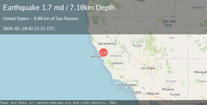
A 1.7 magnitude earthquake struck on 4 km SE of San Ramon, CA, at Fri, 20 Feb 2026 02:33:21 GMT. Depth: 7.09999990463257km. Reviewed by USGS seismologists, this minor quake occurred at a magnitude type of md.
Magnitude
1.7
md
Source
USGS
Intensity
-
Agency Reports
1 Sources| Source | Magnitude | Depth | Time |
|---|---|---|---|
| USGSPrimary | 1.7 | 7 km | 1 hour ago |
Earthquake Details
AutomaticEvent IDusgs_nc75316152
Tsunami PotentialNo
Magnitude Typemd
Nearest Places
- City of San Ramon0.5 km
- San Ramon Village Shopping Center0.5 km
- Canyon Lakes Golf Course0.7 km
- Coyote Creek0.7 km
- Oakwood San Ramon0.9 km
Comments
Join the discussion about this event.
Latest Earthquakes
2.4Mag
Potosi, Bolivia
Time46 minutes ago
Depth182.25 km
SourceVYT (Automatic)
3.6Mag
Java, Indonesia
Time49 minutes ago
Depth0.00 km
SourceVYT (Automatic)
2.0Mag
22 km ENE of San Ardo, CA
Time51 minutes ago
Depth1.42 km
SourceUSGS (Automatic)
0.8Mag
8 km NW of The Geysers, CA
Time56 minutes ago
Depth1.52 km
SourceUSGS (Automatic)
3.9Mag
Coquimbo, Chile
Time1 hour ago
Depth26.98 km
SourceVYT (Automatic)
Nearby Earthquakes
2.3Mag
SAN FRANCISCO BAY AREA, CALIF.
Time2 weeks ago
Depth8.20 km
SourceNC (Automatic)
1.5Mag
4 km ESE of San Ramon, CA
Time4 days ago
Depth7.82 km
SourceUSGS (Automatic)
1.3Mag
4 km SE of San Ramon, CA
Time3 weeks ago
Depth1.02 km
SourceUSGS (Automatic)
2.7Mag
SAN FRANCISCO BAY AREA, CALIF.
Time2 weeks ago
Depth4.60 km
SourceNC (Automatic)
1.9Mag
4 km SE of San Ramon, CA
Time2 weeks ago
Depth8.44 km
SourceUSGS (Automatic)