Earthquake KEPULAUAN TALAUD, INDONESIA
Fri, 13 Feb 2009 12:37:52 GMT
Time17 years ago
Location
3.8000, 126.8700
Depth
46.0 KM
Event Summary
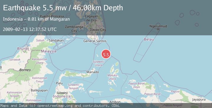
A 5.5 magnitude earthquake struck on KEPULAUAN TALAUD, INDONESIA, at Fri, 13 Feb 2009 12:37:52 GMT. Depth: 46km. Reviewed by EMSC seismologists, this moderate quake occurred at a magnitude type of mw.
Magnitude
5.5
mw
Source
EMSC
Intensity
-
Agency Reports
1 Sources| Source | Magnitude | Depth | Time |
|---|---|---|---|
| EMSCPrimary | 5.5 | 46 km | 17 years ago |
Earthquake Details
AutomaticEvent IDemsc_EMSC_20090213_0000073
Tsunami PotentialNo
Magnitude Typemw
Nearest Places
- Akas4.1 km
- Tanjung Tampida5.6 km
- Birang5.6 km
- Desa Damau Bowone5.8 km
- Desa Akas Balane5.8 km
Comments
Join the discussion about this event.
Latest Earthquakes
3.0Mag
Northern Sumatra, Indonesia
Time4 minutes ago
Depth5.00 km
SourceBMKG
2.9Mag
Salta, Argentina
Time4 minutes ago
Depth296.51 km
SourceVYT (Automatic)
2.4Mag
Sumbawa Region, Indonesia
Time11 minutes ago
Depth20.31 km
SourceBMKG
1.2Mag
3 km N of The Geysers, CA
Time15 minutes ago
Depth1.73 km
SourceUSGS (Automatic)
2.2Mag
Central Alaska
Time18 minutes ago
Depth9.77 km
SourceVYT (Automatic)
Nearby Earthquakes
3.0Mag
KEPULAUAN TALAUD, INDONESIA
Time4 years ago
Depth37.00 km
SourceDJA (Automatic)
4.0Mag
KEPULAUAN TALAUD, INDONESIA
Time3 years ago
Depth23.00 km
SourceDJA (Automatic)
4.0Mag
KEPULAUAN TALAUD, INDONESIA
Time4 years ago
Depth35.00 km
SourceNEIC (Automatic)
3.0Mag
KEPULAUAN TALAUD, INDONESIA
Time2 years ago
Depth19.00 km
SourceDJA (Automatic)
5.1Mag
KEPULAUAN TALAUD, INDONESIA
Time17 years ago
Depth60.00 km
SourceEMSC (Automatic)