Earthquake KEPULAUAN SANGIHE, INDONESIA
Fri, 17 Jul 2009 09:00:15 GMT
Time16 years ago
Location
4.2100, 125.8100
Depth
135.0 KM
Event Summary
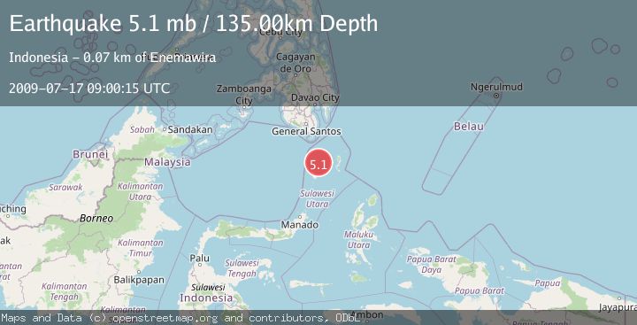
A 5.1 magnitude earthquake struck on KEPULAUAN SANGIHE, INDONESIA, at Fri, 17 Jul 2009 09:00:15 GMT. Depth: 135km. Reviewed by EMSC seismologists, this moderate quake occurred at a magnitude type of mb.
Magnitude
5.1
mb
Source
EMSC
Intensity
-
Agency Reports
1 Sources| Source | Magnitude | Depth | Time |
|---|---|---|---|
| EMSCPrimary | 5.1 | 135 km | 16 years ago |
Earthquake Details
AutomaticEvent IDemsc_EMSC_20090717_0000076
Tsunami PotentialNo
Magnitude Typemb
Nearest Places
- Pulau Dumarehe12.2 km
- Pulau Matutuang28.2 km
- Desa Matutuang28.3 km
- Pulau Buang38.5 km
- Bowone Reef39.0 km
Comments
Join the discussion about this event.
Latest Earthquakes
3.2Mag
Kepulauan Aru region, Indonesia
Time14 minutes ago
Depth92.04 km
SourceVYT (Automatic)
2.7Mag
near the coast of Tarapaca, Chile
Time16 minutes ago
Depth2.08 km
SourceVYT (Automatic)
2.8Mag
WESTERN XIZANG
Time18 minutes ago
Depth10.00 km
SourceNDI (Automatic)
0.9Mag
17 km S of Little Lake, CA
Time19 minutes ago
Depth1.71 km
SourceUSGS (Automatic)
3.4Mag
OKLAHOMA
Time19 minutes ago
Depth0.40 km
SourceOK (Automatic)
Nearby Earthquakes
5.4Mag
KEPULAUAN SANGIHE, INDONESIA
Time10 years ago
Depth148.00 km
SourceEMSC (Automatic)
3.0Mag
KEPULAUAN SANGIHE, INDONESIA
Time4 years ago
Depth38.00 km
SourcePIVS (Automatic)
3.2Mag
Talaud Islands, Indonesia
Time3 weeks ago
Depth128.63 km
SourceBMKG (Automatic)
4.0Mag
KEPULAUAN SANGIHE, INDONESIA
Time3 years ago
Depth124.00 km
SourceDJA (Automatic)
3.0Mag
KEPULAUAN SANGIHE, INDONESIA
Time2 years ago
Depth97.00 km
SourcePIVS (Automatic)