Earthquake KEPULAUAN KAI, INDONESIA
Tue, 12 Jan 2010 10:58:11 GMT
Time16 years ago
Location
-5.4500, 133.8100
Depth
10.0 KM
Event Summary
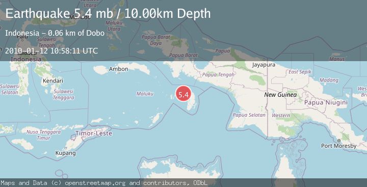
A 5.4 magnitude earthquake struck on KEPULAUAN KAI, INDONESIA, at Tue, 12 Jan 2010 10:58:11 GMT. Depth: 10km. Reviewed by EMSC seismologists, this moderate quake occurred at a magnitude type of mb.
Magnitude
5.4
mb
Source
EMSC
Intensity
-
Agency Reports
1 Sources| Source | Magnitude | Depth | Time |
|---|---|---|---|
| EMSCPrimary | 5.4 | 10 km | 16 years ago |
Earthquake Details
AutomaticEvent IDemsc_EMSC_20100112_0000025
Tsunami PotentialNo
Magnitude Typemb
Nearest Places
- Java Reef49.6 km
- Pulau Wasir51.3 km
- Tanjung Tutupano52.1 km
- Wasir52.1 km
- Selat Wasir53.2 km
Comments
Join the discussion about this event.
Latest Earthquakes
1.7Mag
western Texas
Time4 minutes ago
Depth3.42 km
SourceVYT (Automatic)
3.5Mag
Seram, Indonesia
Time6 minutes ago
Depth0.00 km
SourceVYT (Automatic)
1.6Mag
54 km WNW of Toyah, Texas
Time11 minutes ago
Depth0.00 km
SourceUSGS (Automatic)
2.2Mag
West Papua Region, Indonesia
Time13 minutes ago
Depth26.69 km
SourceBMKG
1.2Mag
WESTERN TURKEY
Time13 minutes ago
Depth7.00 km
SourceAFAD (Automatic)
Nearby Earthquakes
5.3Mag
KEPULAUAN KAI, INDONESIA
Time14 years ago
Depth61.00 km
SourceEMSC (Automatic)
3.0Mag
KEPULAUAN KAI, INDONESIA
Time5 years ago
Depth10.00 km
SourceDJA (Automatic)
7.2Mag
KEPULAUAN KAI, INDONESIA
Time15 years ago
Depth30.00 km
SourceEMSC (Automatic)
5.1Mag
KEPULAUAN KAI, INDONESIA
Time3 months ago
Depth6.50 km
SourceEMSC (Automatic)
5.8Mag
KEPULAUAN KAI, INDONESIA
Time7 years ago
Depth10.00 km
SourceEMSC (Automatic)