Earthquake KEPULAUAN KAI, INDONESIA
Sun, 05 Feb 2012 00:06:01 GMT
Time14 years ago
Location
-5.4700, 133.8500
Depth
61.0 KM
Event Summary
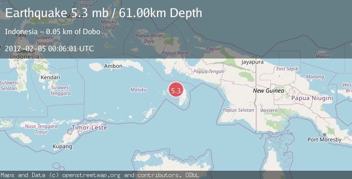
A 5.3 magnitude earthquake struck on KEPULAUAN KAI, INDONESIA, at Sun, 05 Feb 2012 00:06:01 GMT. Depth: 61km. Reviewed by EMSC seismologists, this moderate quake occurred at a magnitude type of mb.
Magnitude
5.3
mb
Source
EMSC
Intensity
-
Agency Reports
1 Sources| Source | Magnitude | Depth | Time |
|---|---|---|---|
| EMSCPrimary | 5.3 | 61 km | 14 years ago |
Earthquake Details
AutomaticEvent IDemsc_EMSC_20120205_0000001
Tsunami PotentialNo
Magnitude Typemb
Nearest Places
- Java Reef45.3 km
- Pulau Wasir46.6 km
- Tanjung Tutupano47.1 km
- Wasir47.4 km
- Wakaltoeltoelak48.3 km
Comments
Join the discussion about this event.
Latest Earthquakes
2.6Mag
Antofagasta, Chile
Time3 minutes ago
Depth0.00 km
SourceVYT (Automatic)
2.8Mag
Fox Islands, Aleutian Islands, Alaska
Time6 minutes ago
Depth80.44 km
SourceVYT (Automatic)
0.9Mag
110 km S of McCarthy, Alaska
Time9 minutes ago
Depth18.50 km
SourceUSGS (Automatic)
3.0Mag
Central Alaska
Time9 minutes ago
Depth0.12 km
SourceVYT (Automatic)
2.5Mag
Minahassa Peninsula, Sulawesi
Time10 minutes ago
Depth4.95 km
SourceBMKG
Nearby Earthquakes
3.0Mag
KEPULAUAN KAI, INDONESIA
Time5 years ago
Depth10.00 km
SourceDJA (Automatic)
5.4Mag
KEPULAUAN KAI, INDONESIA
Time16 years ago
Depth10.00 km
SourceEMSC (Automatic)
4.4Mag
Kepulauan Aru region, Indonesia
Time1 day ago
Depth1.22 km
SourceVYT (Automatic)
5.8Mag
KEPULAUAN KAI, INDONESIA
Time7 years ago
Depth10.00 km
SourceEMSC (Automatic)
5.1Mag
KEPULAUAN KAI, INDONESIA
Time3 months ago
Depth6.50 km
SourceEMSC (Automatic)