Earthquake MOLUCCA SEA
Wed, 10 Feb 2010 20:46:40 GMT
Time16 years ago
Location
1.1400, 126.2100
Depth
10.0 KM
Event Summary
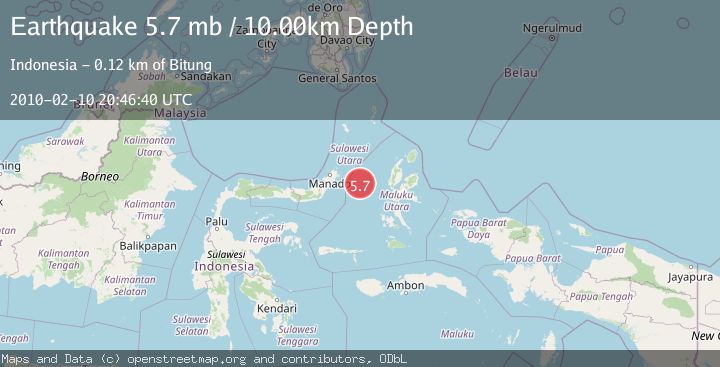
A 5.7 magnitude earthquake struck on MOLUCCA SEA, at Wed, 10 Feb 2010 20:46:40 GMT. Depth: 10km. Reviewed by EMSC seismologists, this moderate quake occurred at a magnitude type of mb.
Magnitude
5.7
mb
Source
EMSC
Intensity
-
Agency Reports
1 Sources| Source | Magnitude | Depth | Time |
|---|---|---|---|
| EMSCPrimary | 5.7 | 10 km | 16 years ago |
Earthquake Details
AutomaticEvent IDemsc_EMSC_20100210_0000034
Tsunami PotentialNo
Magnitude Typemb
Nearest Places
- Pulau Gureda18.4 km
- Kelurahan Pantai Sagu19.9 km
- Pulau Tifore20.1 km
- Kelurahan Tifure20.4 km
- Tanjung Geranomaderi23.9 km
Comments
Join the discussion about this event.
Latest Earthquakes
4.2Mag
Fox Islands, Aleutian Islands, Alaska
Time1 minute ago
Depth0.00 km
SourceVYT (Automatic)
1.8Mag
Sweden
Time2 minutes ago
Depth0.00 km
SourceVYT (Automatic)
2.5Mag
Java, Indonesia
Time3 minutes ago
Depth38.78 km
SourceBMKG
2.4Mag
Poland
Time4 minutes ago
Depth2.81 km
SourceVYT (Automatic)
2.9Mag
Southwest of Sumatra, Indonesia
Time5 minutes ago
Depth10.00 km
SourceBMKG
Nearby Earthquakes
4.9Mag
MOLUCCA SEA
Time1 month ago
Depth46.00 km
SourceEMSC (Automatic)
5.0Mag
MOLUCCA SEA
Time19 years ago
Depth10.00 km
SourceEMSC (Automatic)
3.0Mag
MOLUCCA SEA
Time1 year ago
Depth33.00 km
SourceBMKG (Automatic)
3.0Mag
Molucca Sea
Time1 week ago
Depth37.48 km
SourceVYT (Automatic)
5.2Mag
MOLUCCA SEA
Time19 years ago
Depth10.00 km
SourceEMSC (Automatic)