Earthquake KEPULAUAN BARAT DAYA, INDONESIA
Mon, 15 Feb 2010 21:51:48 GMT
Time16 years ago
Location
-7.3400, 128.7800
Depth
133.0 KM
Event Summary
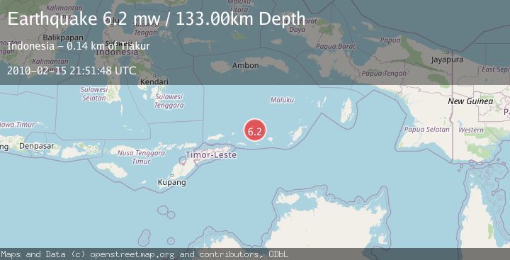
A 6.2 magnitude earthquake struck on KEPULAUAN BARAT DAYA, INDONESIA, at Mon, 15 Feb 2010 21:51:48 GMT. Depth: 133km. Reviewed by EMSC seismologists, this strong quake occurred at a magnitude type of mw.
Magnitude
6.2
mw
Source
EMSC
Intensity
-
Agency Reports
1 Sources| Source | Magnitude | Depth | Time |
|---|---|---|---|
| EMSCPrimary | 6.2 | 133 km | 16 years ago |
Earthquake Details
AutomaticEvent IDemsc_EMSC_20100215_0000034
Tsunami PotentialNo
Magnitude Typemw
Nearest Places
- Tanjung Paran20.5 km
- Tanjung Watlewantutu21.0 km
- Tanjung Tutuwain22.1 km
- Desa Ilih22.5 km
- Teluk Solat23.7 km
Comments
Join the discussion about this event.
Latest Earthquakes
2.8Mag
West Papua Region, Indonesia
Time3 minutes ago
Depth34.12 km
SourceBMKG
2.6Mag
Java, Indonesia
Time13 minutes ago
Depth214.22 km
SourceBMKG
1.0Mag
Southeastern Alaska
Time14 minutes ago
Depth0.00 km
SourceVYT (Automatic)
3.5Mag
COOK STRAIT, NEW ZEALAND
Time15 minutes ago
Depth75.30 km
SourceGNS (Automatic)
2.5Mag
Seram, Indonesia
Time16 minutes ago
Depth21.28 km
SourceBMKG
Nearby Earthquakes
5.9Mag
KEPULAUAN BARAT DAYA, INDONESIA
Time15 years ago
Depth133.00 km
SourceEMSC (Automatic)
5.1Mag
KEPULAUAN BARAT DAYA, INDONESIA
Time20 years ago
Depth200.00 km
SourceEMSC (Automatic)
5.3Mag
KEPULAUAN BARAT DAYA, INDONESIA
Time6 years ago
Depth137.00 km
SourceEMSC (Automatic)
4.0Mag
KEPULAUAN BARAT DAYA, INDONESIA
Time1 year ago
Depth132.30 km
SourceNEIC (Automatic)
5.2Mag
KEPULAUAN BARAT DAYA, INDONESIA
Time3 years ago
Depth161.00 km
SourceEMSC (Automatic)