Earthquake PHILIPPINE ISLANDS REGION
Sat, 25 Dec 2010 21:16:52 GMT
Time15 years ago
Location
6.0300, 127.4700
Depth
76.0 KM
Event Summary
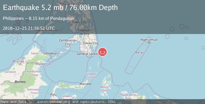
A 5.2 magnitude earthquake struck on PHILIPPINE ISLANDS REGION, at Sat, 25 Dec 2010 21:16:52 GMT. Depth: 76km. Reviewed by EMSC seismologists, this moderate quake occurred at a magnitude type of mb.
Magnitude
5.2
mb
Source
EMSC
Intensity
-
Agency Reports
1 Sources| Source | Magnitude | Depth | Time |
|---|---|---|---|
| EMSCPrimary | 5.2 | 76 km | 15 years ago |
Earthquake Details
AutomaticEvent IDemsc_EMSC_20101225_0000079
Tsunami PotentialNo
Magnitude Typemb
Nearest Places
- Tanjung Dapapa110.3 km
- Desa Pulau Miangas111.2 km
- Pulau Miangas111.3 km
- Kecamatan Miangas111.3 km
- Miangas112.0 km
Comments
Join the discussion about this event.
Latest Earthquakes
2.9Mag
Antofagasta, Chile
Time4 minutes ago
Depth267.46 km
SourceVYT (Automatic)
1.3Mag
10 km NW of Pine Valley, CA
Time4 minutes ago
Depth8.85 km
SourceUSGS (Automatic)
2.3Mag
Alaska Peninsula
Time12 minutes ago
Depth0.00 km
SourceVYT (Automatic)
5.0Mag
Halmahera, Indonesia
Time13 minutes ago
Depth105.96 km
SourceVYT (Automatic)
2.4Mag
Potosi, Bolivia
Time14 minutes ago
Depth182.25 km
SourceVYT (Automatic)
Nearby Earthquakes
3.0Mag
PHILIPPINE ISLANDS REGION
Time2 months ago
Depth15.00 km
SourcePIVS (Automatic)
5.3Mag
PHILIPPINE ISLANDS REGION
Time13 years ago
Depth50.00 km
SourceEMSC (Automatic)
4.0Mag
PHILIPPINE ISLANDS REGION
Time4 years ago
Depth27.00 km
SourcePIVS (Automatic)
3.0Mag
PHILIPPINE ISLANDS REGION
Time3 years ago
Depth117.00 km
SourcePIVS (Automatic)
3.0Mag
PHILIPPINE ISLANDS REGION
Time9 months ago
Depth149.00 km
SourcePIVS (Automatic)