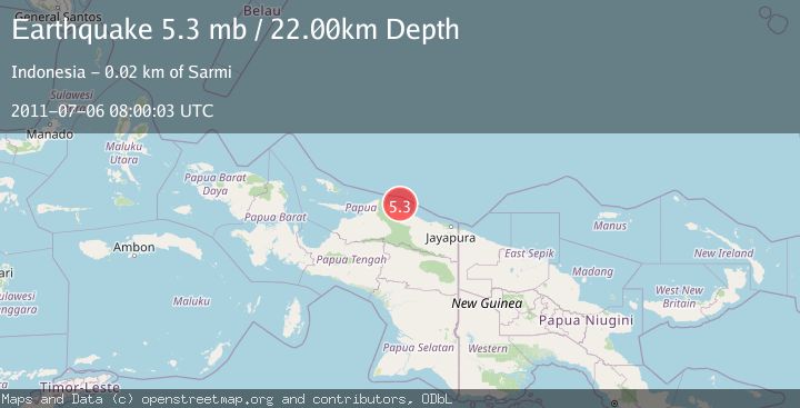
Earthquake NEAR N COAST OF PAPUA, INDONESIA
Wed, 06 Jul 2011 08:00:03 GMT
Time14 years ago
Location
-1.6400, 138.7000
Depth
22.0 KM
Event Summary
A 5.3 magnitude earthquake struck on NEAR N COAST OF PAPUA, INDONESIA, at Wed, 06 Jul 2011 08:00:03 GMT. Depth: 22km. Reviewed by EMSC seismologists, this moderate quake occurred at a magnitude type of mb.
Magnitude
5.3
mb
Source
EMSC
Intensity
-
Agency Reports
1 Sources| Source | Magnitude | Depth | Time |
|---|---|---|---|
| EMSCPrimary | 5.3 | 22 km | 14 years ago |
Earthquake Details
AutomaticEvent IDemsc_EMSC_20110706_0000021
Tsunami PotentialNo
Magnitude Typemb
Nearest Places
- Sau3.2 km
- Pulau Liki4.7 km
- Isyuma4.8 km
- Kampung Liki5.0 km
- Pulau-pulau Kumamba6.3 km
Comments
Join the discussion about this event.
Latest Earthquakes
3.1Mag
Halmahera, Indonesia
Time6 minutes ago
Depth113.40 km
SourceVYT (Automatic)
1.0Mag
6 km WNW of Cobb, CA
Time7 minutes ago
Depth1.71 km
SourceUSGS (Automatic)
1.5Mag
Southern Alaska
Time7 minutes ago
Depth19.90 km
SourceVYT (Automatic)
1.9Mag
British Columbia, Canada
Time17 minutes ago
Depth0.00 km
SourceVYT (Automatic)
0.7Mag
84 km S of McCarthy, Alaska
Time19 minutes ago
Depth11.40 km
SourceUSGS (Automatic)
Nearby Earthquakes
5.0Mag
NEAR N COAST OF PAPUA, INDONESIA
Time17 years ago
Depth10.00 km
SourceGFZ (Automatic)
3.0Mag
NEAR N COAST OF PAPUA, INDONESIA
Time4 months ago
Depth10.00 km
SourceBMKG (Automatic)
3.0Mag
NEAR N COAST OF PAPUA, INDONESIA
Time1 week ago
Depth10.00 km
SourceBMKG (Automatic)
5.0Mag
NEAR N COAST OF PAPUA, INDONESIA
Time6 years ago
Depth10.00 km
SourceEMSC (Automatic)
5.3Mag
NEAR N COAST OF PAPUA, INDONESIA
Time12 years ago
Depth20.00 km
SourceEMSC (Automatic)