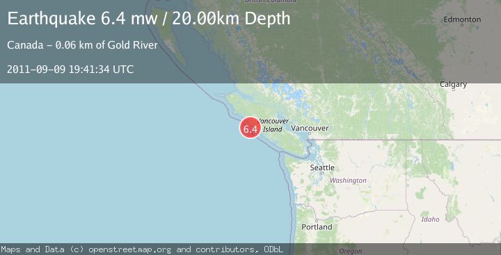
Earthquake VANCOUVER ISLAND, CANADA REGION
Fri, 09 Sep 2011 19:41:34 GMT
Time14 years ago
Location
49.5200, -126.8500
Depth
20.0 KM
Event Summary
A 6.4 magnitude earthquake struck on VANCOUVER ISLAND, CANADA REGION, at Fri, 09 Sep 2011 19:41:34 GMT. Depth: 20km. Reviewed by EMSC seismologists, this strong quake occurred at a magnitude type of mw.
Magnitude
6.4
mw
Source
EMSC
Intensity
-
Agency Reports
1 Sources| Source | Magnitude | Depth | Time |
|---|---|---|---|
| EMSCPrimary | 6.4 | 20 km | 14 years ago |
Earthquake Details
AutomaticEvent IDemsc_EMSC_20110909_0000077
Tsunami PotentialNo
Magnitude Typemw
Nearest Places
- 5.6 km
- 9.7 km
- 10.9 km
- 11.5 km
- 12.0 km
Comments
Join the discussion about this event.
Latest Earthquakes
1.1Mag
9 km NNE of Midland, Texas
Time42 minutes ago
Depth4.73 km
SourceUSGS (Automatic)
3.3Mag
Northern Molucca Sea
Time44 minutes ago
Depth11.24 km
SourceBMKG
1.5Mag
Southern Alaska
Time49 minutes ago
Depth0.12 km
SourceVYT (Automatic)
1.3Mag
Tarapaca, Chile
Time55 minutes ago
Depth0.00 km
SourceVYT (Automatic)
1.8Mag
San Pedro Channel, California
Time56 minutes ago
Depth15.26 km
SourceVYT (Automatic)
Nearby Earthquakes
3.0Mag
VANCOUVER ISLAND, CANADA REGION
Time7 months ago
Depth21.30 km
SourceCN (Automatic)
5.5Mag
VANCOUVER ISLAND, CANADA REGION
Time12 years ago
Depth10.00 km
SourceEMSC (Automatic)
6.5Mag
VANCOUVER ISLAND, CANADA REGION
Time11 years ago
Depth10.00 km
SourceNEIC (Automatic)
3.0Mag
Vancouver Island, Canada region
Time1 week ago
Depth25.88 km
SourceVYT (Automatic)
3.0Mag
VANCOUVER ISLAND, CANADA REGION
Time5 years ago
Depth10.00 km
SourceCN (Automatic)