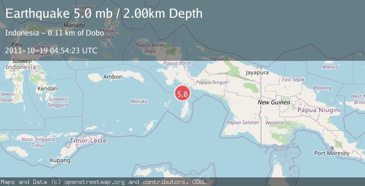
Earthquake NEAR S COAST OF PAPUA, INDONESIA
Wed, 19 Oct 2011 04:54:23 GMT
Time14 years ago
Location
-4.7800, 134.2200
Depth
2.0 KM
Event Summary
A 5.0 magnitude earthquake struck on NEAR S COAST OF PAPUA, INDONESIA, at Wed, 19 Oct 2011 04:54:23 GMT. Depth: 2km. Reviewed by EMSC seismologists, this moderate quake occurred at a magnitude type of mb.
Magnitude
5.0
mb
Source
EMSC
Intensity
-
Agency Reports
1 Sources| Source | Magnitude | Depth | Time |
|---|---|---|---|
| EMSCPrimary | 5.0 | 2 km | 14 years ago |
Earthquake Details
AutomaticEvent IDemsc_EMSC_20111019_0000011
Tsunami PotentialNo
Magnitude Typemb
Nearest Places
- Aru Basin34.5 km
- Pulau Ngoba70.1 km
- Pulau Toba71.5 km
- Java Reef71.9 km
- Tanjung Watuleijuring72.0 km
Comments
Join the discussion about this event.
Latest Earthquakes
2.9Mag
Halmahera, Indonesia
Time7 hours ago
Depth20.39 km
SourceVYT (Automatic)
1.9Mag
Central Alaska
Time7 hours ago
Depth87.40 km
SourceVYT (Automatic)
0.4Mag
6 km NNW of The Geysers, CA
Time7 hours ago
Depth1.69 km
SourceUSGS (Automatic)
2.0Mag
Arizona
Time7 hours ago
Depth12.94 km
SourceVYT (Automatic)
2.5Mag
Antofagasta, Chile
Time7 hours ago
Depth0.24 km
SourceVYT (Automatic)
Nearby Earthquakes
5.2Mag
NEAR S COAST OF PAPUA, INDONESIA
Time16 years ago
Depth30.00 km
SourceEMSC (Automatic)
5.6Mag
NEAR S COAST OF PAPUA, INDONESIA
Time14 years ago
Depth5.00 km
SourceEMSC (Automatic)
5.0Mag
NEAR S COAST OF PAPUA, INDONESIA
Time12 years ago
Depth30.00 km
SourceEMSC (Automatic)
5.1Mag
NEAR S COAST OF PAPUA, INDONESIA
Time5 years ago
Depth10.00 km
SourceEMSC (Automatic)
5.4Mag
NEAR S COAST OF PAPUA, INDONESIA
Time16 years ago
Depth35.00 km
SourceEMSC (Automatic)