Earthquake KEPULAUAN BARAT DAYA, INDONESIA
Tue, 28 Feb 2012 23:52:34 GMT
Time13 years ago
Location
-7.5100, 128.2600
Depth
150.0 KM
Event Summary
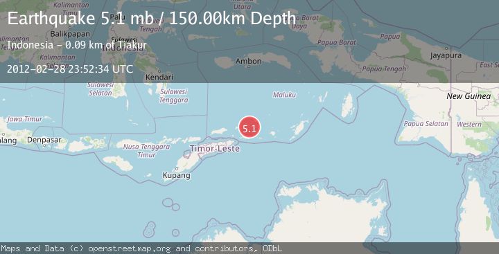
A 5.1 magnitude earthquake struck on KEPULAUAN BARAT DAYA, INDONESIA, at Tue, 28 Feb 2012 23:52:34 GMT. Depth: 150km. Reviewed by EMSC seismologists, this moderate quake occurred at a magnitude type of mb.
Magnitude
5.1
mb
Source
EMSC
Intensity
-
Agency Reports
1 Sources| Source | Magnitude | Depth | Time |
|---|---|---|---|
| EMSCPrimary | 5.1 | 150 km | 13 years ago |
Earthquake Details
AutomaticEvent IDemsc_EMSC_20120228_0000060
Tsunami PotentialNo
Magnitude Typemb
Nearest Places
- Kepulauan Barat Daya30.5 km
- Pulau Musleur35.7 km
- Pulau Terbang Selatan36.5 km
- Pulau Terbang Utara40.9 km
- Tanjung Tutitlakani50.6 km
Comments
Join the discussion about this event.
Latest Earthquakes
2.5Mag
Java, Indonesia
Time3 minutes ago
Depth76.49 km
SourceBMKG
1.9Mag
Tarapaca, Chile
Time9 minutes ago
Depth7.93 km
SourceVYT (Automatic)
2.4Mag
West Papua Region, Indonesia
Time9 minutes ago
Depth10.00 km
SourceBMKG
2.7Mag
Antofagasta, Chile
Time11 minutes ago
Depth0.00 km
SourceVYT (Automatic)
2.7Mag
Tarapaca, Chile
Time16 minutes ago
Depth10.50 km
SourceVYT (Automatic)
Nearby Earthquakes
5.5Mag
KEPULAUAN BARAT DAYA, INDONESIA
Time16 years ago
Depth166.00 km
SourceEMSC (Automatic)
5.2Mag
KEPULAUAN BARAT DAYA, INDONESIA
Time8 years ago
Depth158.00 km
SourceEMSC (Automatic)
4.0Mag
KEPULAUAN BARAT DAYA, INDONESIA
Time10 months ago
Depth143.00 km
SourceBMKG (Automatic)
5.0Mag
KEPULAUAN BARAT DAYA, INDONESIA
Time10 years ago
Depth155.00 km
SourceEMSC (Automatic)
5.0Mag
KEPULAUAN BARAT DAYA, INDONESIA
Time17 years ago
Depth144.00 km
SourceEMSC (Automatic)