Earthquake SOUTHERN SUMATRA, INDONESIA
Wed, 18 Jul 2012 04:33:59 GMT
Time13 years ago
Location
-4.4800, 102.6600
Depth
60.0 KM
Event Summary
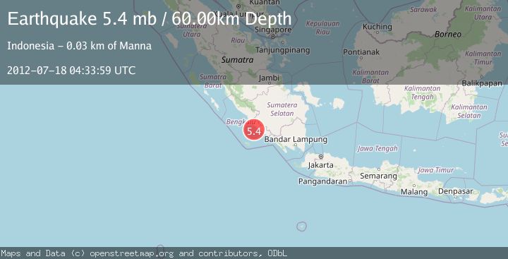
A 5.4 magnitude earthquake struck on SOUTHERN SUMATRA, INDONESIA, at Wed, 18 Jul 2012 04:33:59 GMT. Depth: 60km. Reviewed by EMSC seismologists, this moderate quake occurred at a magnitude type of mb.
Magnitude
5.4
mb
Source
EMSC
Intensity
-
Agency Reports
1 Sources| Source | Magnitude | Depth | Time |
|---|---|---|---|
| EMSCPrimary | 5.4 | 60 km | 13 years ago |
Earthquake Details
AutomaticEvent IDemsc_EMSC_20120718_0000012
Tsunami PotentialNo
Magnitude Typemb
Nearest Places
- Air Alas20.1 km
- Pasaralas20.3 km
- Desa Tedunan20.4 km
- Air Maras20.5 km
- Desa Ketapang Baru20.6 km
Comments
Join the discussion about this event.
Latest Earthquakes
2.0Mag
CENTRAL CALIFORNIA
Time2 minutes ago
Depth3.10 km
SourceNC (Automatic)
2.8Mag
Sumba Region, Indonesia
Time5 minutes ago
Depth8.80 km
SourceBMKG
2.1Mag
Tarapaca, Chile
Time6 minutes ago
Depth115.11 km
SourceVYT (Automatic)
1.7Mag
35 km SSE of King Salmon, Alaska
Time7 minutes ago
Depth9.10 km
SourceUSGS (Automatic)
2.1Mag
Sweden
Time11 minutes ago
Depth0.00 km
SourceVYT (Automatic)
Nearby Earthquakes
3.0Mag
SOUTHERN SUMATRA, INDONESIA
Time2 years ago
Depth39.00 km
SourceDJA (Automatic)
5.0Mag
SOUTHERN SUMATRA, INDONESIA
Time4 years ago
Depth60.00 km
SourceEMSC (Automatic)
3.0Mag
SOUTHERN SUMATRA, INDONESIA
Time2 years ago
Depth40.00 km
SourceBMKG (Automatic)
5.3Mag
SOUTHERN SUMATRA, INDONESIA
Time16 years ago
Depth62.00 km
SourceEMSC (Automatic)
5.2Mag
SOUTHERN SUMATRA, INDONESIA
Time4 years ago
Depth60.00 km
SourceEMSC (Automatic)