Earthquake SOUTH OF KERMADEC ISLANDS
Fri, 24 Aug 2012 10:01:54 GMT
Time13 years ago
Location
-33.3900, -179.4600
Depth
40.0 KM
Event Summary
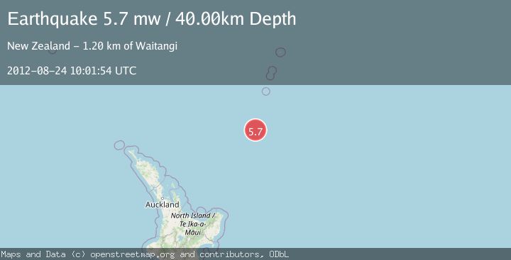
A 5.7 magnitude earthquake struck on SOUTH OF KERMADEC ISLANDS, at Fri, 24 Aug 2012 10:01:54 GMT. Depth: 40km. Reviewed by EMSC seismologists, this moderate quake occurred at a magnitude type of mw.
Magnitude
5.7
mw
Source
EMSC
Intensity
-
Agency Reports
1 Sources| Source | Magnitude | Depth | Time |
|---|---|---|---|
| EMSCPrimary | 5.7 | 40 km | 13 years ago |
Earthquake Details
AutomaticEvent IDemsc_EMSC_20120824_0000033
Tsunami PotentialNo
Magnitude Typemw
Nearest Places
- Kuiwai Seamount49.6 km
- Ngātoroirangi Seamount78.9 km
- Haungaroa Seamount87.1 km
- Speight Knoll112.2 km
- Oliver Knoll112.5 km
Comments
Join the discussion about this event.
Latest Earthquakes
1.7Mag
British Columbia, Canada
Time3 minutes ago
Depth15.99 km
SourceVYT (Automatic)
1.7Mag
7 km SSE of Pāhala, Hawaii
Time4 minutes ago
Depth43.23 km
SourceUSGS (Automatic)
1.6Mag
36 km NNW of Mentone, Texas
Time7 minutes ago
Depth7.26 km
SourceUSGS (Automatic)
2.8Mag
South Australia
Time7 minutes ago
Depth10.00 km
SourceVYT (Automatic)
2.4Mag
Finland-Russia border region
Time7 minutes ago
Depth0.00 km
SourceVYT (Automatic)
Nearby Earthquakes
5.2Mag
SOUTH OF KERMADEC ISLANDS
Time16 years ago
Depth80.00 km
SourceEMSC (Automatic)
5.0Mag
SOUTH OF KERMADEC ISLANDS
Time2 years ago
Depth10.00 km
SourceEMSC (Automatic)
5.9Mag
SOUTH OF KERMADEC ISLANDS
Time1 year ago
Depth31.60 km
SourceEMSC (Automatic)
5.4Mag
SOUTH OF KERMADEC ISLANDS
Time11 years ago
Depth48.00 km
SourceEMSC (Automatic)
5.2Mag
SOUTH OF KERMADEC ISLANDS
Time18 years ago
Depth51.00 km
SourceEMSC (Automatic)