Earthquake BALI SEA
Fri, 09 Nov 2012 15:07:52 GMT
Time13 years ago
Location
-7.9900, 117.6300
Depth
40.0 KM
Event Summary
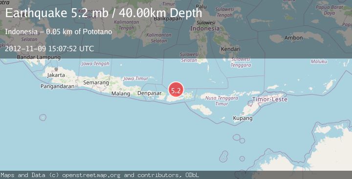
A 5.2 magnitude earthquake struck on BALI SEA, at Fri, 09 Nov 2012 15:07:52 GMT. Depth: 40km. Reviewed by EMSC seismologists, this moderate quake occurred at a magnitude type of mb.
Magnitude
5.2
mb
Source
EMSC
Intensity
-
Agency Reports
1 Sources| Source | Magnitude | Depth | Time |
|---|---|---|---|
| EMSCPrimary | 5.2 | 40 km | 13 years ago |
Earthquake Details
AutomaticEvent IDemsc_EMSC_20121109_0000081
Tsunami PotentialNo
Magnitude Typemb
Nearest Places
- Tanjung Panda17.9 km
- Satonda Peak18.1 km
- Teluk Patedong18.1 km
- Sebaru18.1 km
- Patedong18.2 km
Comments
Join the discussion about this event.
Latest Earthquakes
2.2Mag
Seram, Indonesia
Time14 hours ago
Depth19.61 km
SourceBMKG
2.2Mag
Sweden
Time14 hours ago
Depth0.00 km
SourceVYT (Automatic)
1.5Mag
Southeastern Alaska
Time14 hours ago
Depth0.00 km
SourceVYT (Automatic)
1.6Mag
5 km NNW of Boron, CA
Time14 hours ago
Depth-0.63 km
SourceUSGS (Automatic)
2.3Mag
Ceram Sea
Time14 hours ago
Depth10.00 km
SourceBMKG
Nearby Earthquakes
2.5Mag
BALI SEA
Time1 month ago
Depth24.00 km
SourceBMKG (Automatic)
2.4Mag
Bali Sea
Time3 weeks ago
Depth10.00 km
SourceBMKG (Automatic)
2.3Mag
Bali Sea
Time2 weeks ago
Depth10.00 km
SourceBMKG (Automatic)
2.1Mag
Bali Sea
Time3 weeks ago
Depth8.11 km
SourceBMKG (Automatic)
4.0Mag
SUMBAWA REGION, INDONESIA
Time2 years ago
Depth242.00 km
SourceNEIC (Automatic)