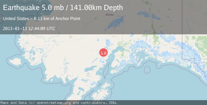
Earthquake SOUTHERN ALASKA
Sun, 13 Jan 2013 12:44:09 GMT
Time13 years ago
Location
60.7900, -153.0100
Depth
141.0 KM
Event Summary
A 5.0 magnitude earthquake struck on SOUTHERN ALASKA, at Sun, 13 Jan 2013 12:44:09 GMT. Depth: 141km. Reviewed by EMSC seismologists, this moderate quake occurred at a magnitude type of mb.
Magnitude
5.0
mb
Source
EMSC
Intensity
-
Agency Reports
1 Sources| Source | Magnitude | Depth | Time |
|---|---|---|---|
| EMSCPrimary | 5.0 | 141 km | 13 years ago |
Earthquake Details
AutomaticEvent IDemsc_EMSC_20130113_0000049
Tsunami PotentialNo
Magnitude Typemb
Nearest Places
- Glacier Fork Tlikakila River9.1 km
- Summit Lake12.0 km
- North Fork Tlikakila River15.1 km
- Tanaina Glacier15.2 km
- Lake Clark Pass16.2 km
Comments
Join the discussion about this event.
Latest Earthquakes
1.6Mag
Southern Alaska
Time11 minutes ago
Depth48.58 km
SourceVYT (Automatic)
2.2Mag
PUERTO RICO
Time12 minutes ago
Depth13.80 km
SourcePR (Automatic)
2.3Mag
Antofagasta, Chile
Time13 minutes ago
Depth82.15 km
SourceVYT (Automatic)
2.1Mag
Southern Alaska
Time16 minutes ago
Depth64.21 km
SourceVYT (Automatic)
2.5Mag
Central Alaska
Time21 minutes ago
Depth312.99 km
SourceVYT (Automatic)
Nearby Earthquakes
0.9Mag
Southern Alaska
Time6 days ago
Depth0.00 km
SourceVYT (Automatic)
1.2Mag
Southern Alaska
Time5 days ago
Depth7.81 km
SourceVYT (Automatic)
0.8Mag
Southern Alaska
Time5 days ago
Depth19.65 km
SourceVYT (Automatic)
1.4Mag
Southern Alaska
Time1 week ago
Depth14.16 km
SourceVYT (Automatic)
2.4Mag
SOUTHERN ALASKA
Time1 month ago
Depth150.40 km
SourceNEIC (Automatic)