Earthquake SOUTH OF BALI, INDONESIA
Mon, 23 Sep 2013 15:12:57 GMT
Time12 years ago
Location
-9.9800, 115.9900
Depth
53.0 KM
Event Summary
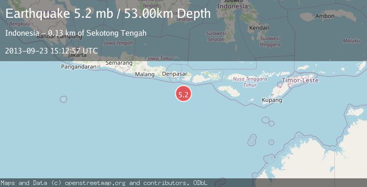
A 5.2 magnitude earthquake struck on SOUTH OF BALI, INDONESIA, at Mon, 23 Sep 2013 15:12:57 GMT. Depth: 53km. Reviewed by EMSC seismologists, this moderate quake occurred at a magnitude type of mb.
Magnitude
5.2
mb
Source
EMSC
Intensity
-
Agency Reports
1 Sources| Source | Magnitude | Depth | Time |
|---|---|---|---|
| EMSCPrimary | 5.2 | 53 km | 12 years ago |
Earthquake Details
AutomaticEvent IDemsc_EMSC_20130923_0000067
Tsunami PotentialNo
Magnitude Typemb
Nearest Places
- Lombok Basin16.4 km
- Pulau Sophialouisa117.3 km
- Tanjung Panggang119.9 km
- Gili Sarangburung120.2 km
- Tanjung Tampah120.4 km
Comments
Join the discussion about this event.
Latest Earthquakes
2.5Mag
Java, Indonesia
Time4 minutes ago
Depth76.49 km
SourceBMKG
1.9Mag
Tarapaca, Chile
Time9 minutes ago
Depth7.93 km
SourceVYT (Automatic)
2.4Mag
West Papua Region, Indonesia
Time10 minutes ago
Depth10.00 km
SourceBMKG
2.7Mag
Antofagasta, Chile
Time12 minutes ago
Depth0.00 km
SourceVYT (Automatic)
2.7Mag
Tarapaca, Chile
Time16 minutes ago
Depth10.50 km
SourceVYT (Automatic)
Nearby Earthquakes
3.0Mag
Sumbawa Region, Indonesia
Time3 weeks ago
Depth10.00 km
SourceBMKG (Automatic)
4.0Mag
LOMBOK REGION, INDONESIA
Time2 years ago
Depth10.00 km
SourceDJA (Automatic)
5.2Mag
LOMBOK REGION, INDONESIA
Time10 years ago
Depth80.00 km
SourceEMSC (Automatic)
3.0Mag
SOUTH OF BALI, INDONESIA
Time5 years ago
Depth10.00 km
SourceDJA (Automatic)
4.0Mag
SOUTH OF BALI, INDONESIA
Time1 year ago
Depth10.00 km
SourceBMKG (Automatic)