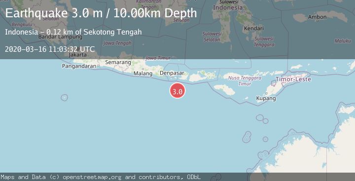
Earthquake SOUTH OF BALI, INDONESIA
Mon, 16 Mar 2020 11:03:32 GMT
Time5 years ago
Location
-9.8400, 115.7300
Depth
10.0 KM
Event Summary
A 3.0 magnitude earthquake struck on SOUTH OF BALI, INDONESIA, at Mon, 16 Mar 2020 11:03:32 GMT. Depth: 10km. Reviewed by DJA seismologists, this minor quake occurred at a magnitude type of m.
Magnitude
3.0
m
Source
DJA
Intensity
-
Agency Reports
1 Sources| Source | Magnitude | Depth | Time |
|---|---|---|---|
| DJAPrimary | 3.0 | 10 km | 5 years ago |
Earthquake Details
AutomaticEvent IDemsc_DJA_20200316_0000078
Tsunami PotentialNo
Magnitude Typem
Nearest Places
- Lombok Basin29.6 km
- Pulau Sophialouisa106.1 km
- Gili Sarangburung108.6 km
- Tanjung Panggang109.1 km
- Gili Luah109.3 km
Comments
Join the discussion about this event.
Latest Earthquakes
1.0Mag
Southeastern Alaska
Time6 minutes ago
Depth0.00 km
SourceVYT (Automatic)
3.5Mag
COOK STRAIT, NEW ZEALAND
Time7 minutes ago
Depth75.30 km
SourceGNS (Automatic)
2.5Mag
Seram, Indonesia
Time9 minutes ago
Depth21.28 km
SourceBMKG
2.6Mag
West Papua Region, Indonesia
Time12 minutes ago
Depth17.35 km
SourceBMKG
5.0Mag
CENTRAL MID-ATLANTIC RIDGE
Time12 minutes ago
Depth10.00 km
SourceEMSC (Automatic)
Nearby Earthquakes
3.0Mag
SOUTH OF BALI, INDONESIA
Time4 years ago
Depth10.00 km
SourceDJA (Automatic)
3.0Mag
SOUTH OF BALI, INDONESIA
Time2 months ago
Depth10.00 km
SourceBMKG (Automatic)
4.0Mag
SOUTH OF BALI, INDONESIA
Time1 year ago
Depth10.00 km
SourceBMKG (Automatic)
3.0Mag
SOUTH OF BALI, INDONESIA
Time5 years ago
Depth10.00 km
SourceDJA (Automatic)
2.6Mag
South of Bali, Indonesia
Time1 week ago
Depth14.96 km
SourceBMKG (Automatic)