Earthquake SOUTHEAST OF LOYALTY ISLANDS
Mon, 02 Dec 2013 02:14:58 GMT
Time12 years ago
Location
-21.2300, 170.2900
Depth
115.0 KM
Event Summary
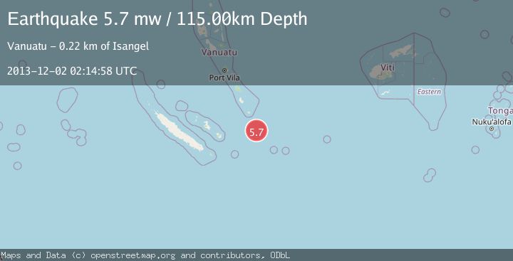
A 5.7 magnitude earthquake struck on SOUTHEAST OF LOYALTY ISLANDS, at Mon, 02 Dec 2013 02:14:58 GMT. Depth: 115km. Reviewed by EMSC seismologists, this moderate quake occurred at a magnitude type of mw.
Magnitude
5.7
mw
Source
EMSC
Intensity
-
Agency Reports
1 Sources| Source | Magnitude | Depth | Time |
|---|---|---|---|
| EMSCPrimary | 5.7 | 115 km | 12 years ago |
Earthquake Details
AutomaticEvent IDemsc_EMSC_20131202_0000016
Tsunami PotentialNo
Magnitude Typemw
Nearest Places
- Anowon Nis Inicen Point117.7 km
- Niav Rock117.8 km
- Anowan-Avacuinicado Beach117.9 km
- Ahrae Point117.9 km
- Itaha Beach117.9 km
Comments
Join the discussion about this event.
Latest Earthquakes
4.2Mag
Kepulauan Talaud, Indonesia
Time7 minutes ago
Depth85.57 km
SourceVYT (Automatic)
2.0Mag
Antofagasta, Chile
Time9 minutes ago
Depth127.32 km
SourceVYT (Automatic)
2.0Mag
Southern California
Time18 minutes ago
Depth14.40 km
SourceVYT (Automatic)
3.0Mag
Potosi, Bolivia
Time20 minutes ago
Depth188.11 km
SourceVYT (Automatic)
1.3Mag
9 km WNW of The Geysers, CA
Time21 minutes ago
Depth2.36 km
SourceUSGS (Automatic)
Nearby Earthquakes
7.0Mag
SOUTHEAST OF LOYALTY ISLANDS
Time3 years ago
Depth139.00 km
SourceEMSC (Automatic)
5.2Mag
SOUTHEAST OF LOYALTY ISLANDS
Time18 years ago
Depth80.00 km
SourceEMSC (Automatic)
6.0Mag
SOUTHEAST OF LOYALTY ISLANDS
Time11 years ago
Depth10.00 km
SourceNEIC (Automatic)
5.6Mag
SOUTHEAST OF LOYALTY ISLANDS
Time11 years ago
Depth10.00 km
SourceEMSC (Automatic)
5.2Mag
SOUTHEAST OF LOYALTY ISLANDS
Time9 years ago
Depth200.00 km
SourceEMSC (Automatic)