Earthquake NEAR S COAST OF PAPUA, INDONESIA
Sun, 26 Jan 2014 19:55:01 GMT
Time12 years ago
Location
-4.8100, 134.0000
Depth
29.0 KM
Event Summary
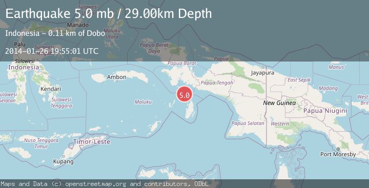
A 5.0 magnitude earthquake struck on NEAR S COAST OF PAPUA, INDONESIA, at Sun, 26 Jan 2014 19:55:01 GMT. Depth: 29km. Reviewed by EMSC seismologists, this moderate quake occurred at a magnitude type of mb.
Magnitude
5.0
mb
Source
EMSC
Intensity
-
Agency Reports
1 Sources| Source | Magnitude | Depth | Time |
|---|---|---|---|
| EMSCPrimary | 5.0 | 29 km | 12 years ago |
Earthquake Details
AutomaticEvent IDemsc_EMSC_20140126_0000097
Tsunami PotentialNo
Magnitude Typemb
Nearest Places
- Aru Basin21.1 km
- Java Reef74.2 km
- Tanjung Watukebo74.9 km
- Pulau Tumbutumbu76.8 km
- Pulau Toba81.4 km
Comments
Join the discussion about this event.
Latest Earthquakes
2.2Mag
Java, Indonesia
Time15 hours ago
Depth30.94 km
SourceBMKG
2.0Mag
Seram, Indonesia
Time15 hours ago
Depth68.21 km
SourceBMKG
3.5Mag
near the coast of Antofagasta, Chile
Time15 hours ago
Depth0.00 km
SourceVYT (Automatic)
3.3Mag
SALTA, ARGENTINA
Time15 hours ago
Depth188.00 km
SourceNSNA (Automatic)
1.7Mag
Southern California
Time15 hours ago
Depth0.00 km
SourceVYT (Automatic)
Nearby Earthquakes
5.0Mag
NEAR S COAST OF PAPUA, INDONESIA
Time11 years ago
Depth12.00 km
SourceEMSC (Automatic)
5.5Mag
NEAR S COAST OF PAPUA, INDONESIA
Time2 years ago
Depth10.00 km
SourceEMSC (Automatic)
4.0Mag
NEAR S COAST OF PAPUA, INDONESIA
Time2 years ago
Depth10.00 km
SourceDJA (Automatic)
4.8Mag
Papua region, Indonesia
Time1 week ago
Depth10.00 km
SourceVYT (Automatic)
5.0Mag
NEAR S COAST OF PAPUA, INDONESIA
Time13 years ago
Depth10.00 km
SourceEMSC (Automatic)