Earthquake Papua region, Indonesia
Wed, 11 Feb 2026 18:34:15 GMT
Time1 week ago
Location
-4.7278, 133.9720
Depth
10.0 KM
Event Summary
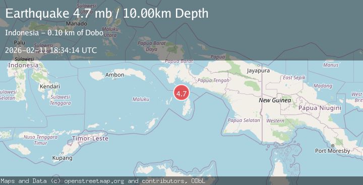
A 4.8 magnitude earthquake struck on Papua region, Indonesia, at Wed, 11 Feb 2026 18:34:15 GMT. Depth: 10km. Reviewed by VYT seismologists, this light quake occurred at a magnitude type of earthquake.
Magnitude
4.8
earthquake
Source
VYT
Intensity
-
Agency Reports
5 Sources| Source | Magnitude | Depth | Time |
|---|---|---|---|
| VYTPrimary | 4.8 | 10 km | 1 week ago |
| BMKG | 4.8 | 99 km | 1 week ago |
| GFZ | 4.7 | 10 km | 1 week ago |
| NEIC | 4.7 | 10 km | 1 week ago |
| EMSC | 4.7 | 10 km | 1 week ago |
Earthquake Details
AutomaticEvent IDvyt_2z5hxrronp0dr
Tsunami PotentialNo
Magnitude Typeearthquake
Nearest Places
- Aru Basin30.4 km
- Tanjung Watukebo65.8 km
- Pulau Tumbutumbu68.4 km
- Kampung Adi Jaya78.8 km
- Manggawitu82.3 km
Comments
Join the discussion about this event.
Latest Earthquakes
2.1Mag
Kenai Peninsula, Alaska
Time18 hours ago
Depth0.00 km
SourceVYT (Automatic)
0.9Mag
4 km SSE of Banning, CA
Time18 hours ago
Depth12.80 km
SourceUSGS (Automatic)
1.9Mag
Poland
Time18 hours ago
Depth5.25 km
SourceVYT (Automatic)
2.0Mag
Central California
Time18 hours ago
Depth0.00 km
SourceVYT (Automatic)
0.7Mag
4 km NW of The Geysers, CA
Time18 hours ago
Depth3.05 km
SourceUSGS (Automatic)
Nearby Earthquakes
5.5Mag
NEAR S COAST OF PAPUA, INDONESIA
Time2 years ago
Depth10.00 km
SourceEMSC (Automatic)
4.0Mag
NEAR S COAST OF PAPUA, INDONESIA
Time2 years ago
Depth10.00 km
SourceDJA (Automatic)
3.2Mag
West Papua Region, Indonesia
Time6 days ago
Depth10.00 km
SourceBMKG
5.0Mag
NEAR S COAST OF PAPUA, INDONESIA
Time12 years ago
Depth29.00 km
SourceEMSC (Automatic)
5.0Mag
NEAR S COAST OF PAPUA, INDONESIA
Time13 years ago
Depth14.00 km
SourceEMSC (Automatic)