Earthquake MOLUCCA SEA
Wed, 10 Sep 2014 02:46:07 GMT
Time11 years ago
Location
-0.1000, 125.2000
Depth
30.0 KM
Event Summary
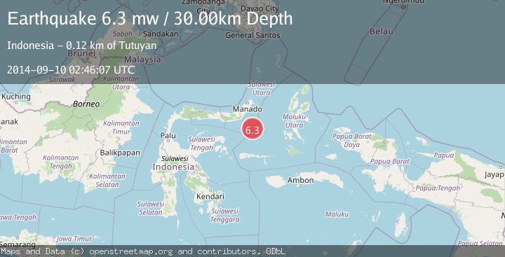
A 6.3 magnitude earthquake struck on MOLUCCA SEA, at Wed, 10 Sep 2014 02:46:07 GMT. Depth: 30km. Reviewed by EMSC seismologists, this strong quake occurred at a magnitude type of mw.
Magnitude
6.3
mw
Source
EMSC
Intensity
-
Agency Reports
1 Sources| Source | Magnitude | Depth | Time |
|---|---|---|---|
| EMSCPrimary | 6.3 | 30 km | 11 years ago |
Earthquake Details
AutomaticEvent IDemsc_EMSC_20140910_0000006
Tsunami PotentialNo
Magnitude Typemw
Nearest Places
- Batu Mandi98.3 km
- Tanjung Flesko99.5 km
- Tanjung Palureoi99.9 km
- Tanjung Payongan100.7 km
- Pulau Lampu100.8 km
Comments
Join the discussion about this event.
Latest Earthquakes
0.7Mag
8 km NW of The Geysers, CA
Time3 minutes ago
Depth1.59 km
SourceUSGS (Automatic)
1.2Mag
Southern Alaska
Time4 minutes ago
Depth16.72 km
SourceVYT (Automatic)
1.6Mag
49 km W of Mentone, Texas
Time5 minutes ago
Depth4.59 km
SourceUSGS (Automatic)
3.1Mag
northern Colombia
Time6 minutes ago
Depth219.97 km
SourceVYT (Automatic)
2.2Mag
Sumbawa Region, Indonesia
Time9 minutes ago
Depth15.54 km
SourceBMKG
Nearby Earthquakes
5.2Mag
MOLUCCA SEA
Time8 years ago
Depth60.00 km
SourceEMSC (Automatic)
3.9Mag
MOLUCCA SEA
Time1 month ago
Depth10.00 km
SourceBMKG (Automatic)
5.3Mag
MOLUCCA SEA
Time14 years ago
Depth40.00 km
SourceEMSC (Automatic)
5.5Mag
MOLUCCA SEA
Time8 years ago
Depth50.00 km
SourceEMSC (Automatic)
5.2Mag
MOLUCCA SEA
Time15 years ago
Depth51.00 km
SourceEMSC (Automatic)