Earthquake MOLUCCA SEA
Wed, 10 Sep 2014 09:33:02 GMT
Time11 years ago
Location
-0.2500, 125.2500
Depth
52.0 KM
Event Summary
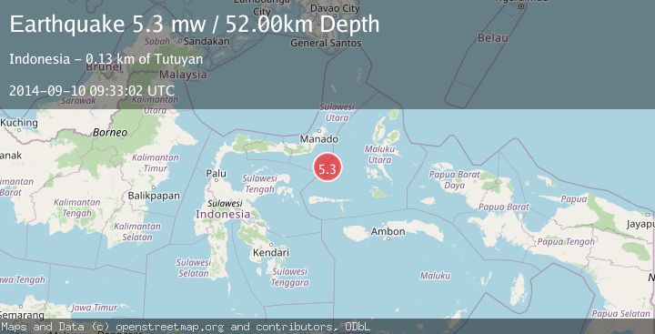
A 5.3 magnitude earthquake struck on MOLUCCA SEA, at Wed, 10 Sep 2014 09:33:02 GMT. Depth: 52km. Reviewed by EMSC seismologists, this moderate quake occurred at a magnitude type of mw.
Magnitude
5.3
mw
Source
EMSC
Intensity
-
Agency Reports
1 Sources| Source | Magnitude | Depth | Time |
|---|---|---|---|
| EMSCPrimary | 5.3 | 52 km | 11 years ago |
Earthquake Details
AutomaticEvent IDemsc_EMSC_20140910_0000029
Tsunami PotentialNo
Magnitude Typemw
Nearest Places
- Batu Mandi113.6 km
- Tanjung Flesko114.8 km
- Tanjung Palureoi115.3 km
- Pulau Lampu115.7 km
- Tanjung Payongan116.1 km
Comments
Join the discussion about this event.
Latest Earthquakes
2.6Mag
West Papua Region, Indonesia
Time3 minutes ago
Depth17.35 km
SourceBMKG
2.8Mag
Antofagasta, Chile
Time7 minutes ago
Depth0.00 km
SourceVYT (Automatic)
3.3Mag
Near North Coast of West Papua
Time8 minutes ago
Depth10.00 km
SourceBMKG
2.5Mag
off the coast of Tarapaca, Chile
Time9 minutes ago
Depth0.00 km
SourceVYT (Automatic)
2.6Mag
Sunda Strait, Indonesia
Time11 minutes ago
Depth8.74 km
SourceBMKG
Nearby Earthquakes
5.8Mag
MOLUCCA SEA
Time20 years ago
Depth30.00 km
SourceEMSC (Automatic)
5.0Mag
MOLUCCA SEA
Time1 year ago
Depth61.40 km
SourceEMSC (Automatic)
5.0Mag
MOLUCCA SEA
Time11 years ago
Depth55.00 km
SourceEMSC (Automatic)
5.1Mag
MOLUCCA SEA
Time5 years ago
Depth60.00 km
SourceEMSC (Automatic)
4.6Mag
Southern Molucca Sea
Time3 weeks ago
Depth10.00 km
SourceBMKG (Automatic)