Earthquake MOLUCCA SEA
Tue, 17 Feb 2015 02:14:55 GMT
Time11 years ago
Location
0.6700, 126.1600
Depth
8.0 KM
Event Summary
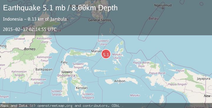
A 5.1 magnitude earthquake struck on MOLUCCA SEA, at Tue, 17 Feb 2015 02:14:55 GMT. Depth: 8km. Reviewed by EMSC seismologists, this moderate quake occurred at a magnitude type of mb.
Magnitude
5.1
mb
Source
EMSC
Intensity
-
Agency Reports
1 Sources| Source | Magnitude | Depth | Time |
|---|---|---|---|
| EMSCPrimary | 5.1 | 8 km | 11 years ago |
Earthquake Details
AutomaticEvent IDemsc_EMSC_20150217_0000004
Tsunami PotentialNo
Magnitude Typemb
Nearest Places
- Maluku Sea26.0 km
- Kelurahan Tifure33.2 km
- Pulau Tifore33.8 km
- Kelurahan Pantai Sagu34.3 km
- Pulau Gureda35.3 km
Comments
Join the discussion about this event.
Latest Earthquakes
4.5Mag
North of Halmahera, Indonesia
Time3 minutes ago
Depth10.00 km
SourceBMKG
3.1Mag
Bali Region, Indonesia
Time9 minutes ago
Depth19.14 km
SourceBMKG
2.7Mag
Coquimbo, Chile
Time11 minutes ago
Depth14.16 km
SourceVYT (Automatic)
1.7Mag
Southeastern Alaska
Time13 minutes ago
Depth5.98 km
SourceVYT (Automatic)
2.1Mag
Tarapaca, Chile
Time14 minutes ago
Depth110.35 km
SourceVYT (Automatic)
Nearby Earthquakes
3.0Mag
MOLUCCA SEA
Time4 years ago
Depth10.00 km
SourceDJA (Automatic)
3.5Mag
MOLUCCA SEA
Time1 month ago
Depth10.00 km
SourceBMKG (Automatic)
5.3Mag
MOLUCCA SEA
Time11 years ago
Depth46.00 km
SourceEMSC (Automatic)
5.1Mag
MOLUCCA SEA
Time4 years ago
Depth45.00 km
SourceEMSC (Automatic)
5.6Mag
MOLUCCA SEA
Time7 years ago
Depth45.00 km
SourceEMSC (Automatic)