Earthquake KEPULAUAN BABAR, INDONESIA
Mon, 02 Nov 2015 16:36:48 GMT
Time10 years ago
Location
-7.0100, 129.6500
Depth
128.0 KM
Event Summary
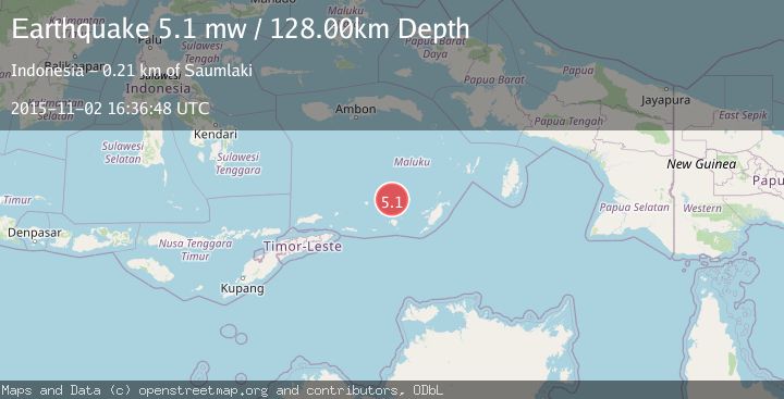
A 5.1 magnitude earthquake struck on KEPULAUAN BABAR, INDONESIA, at Mon, 02 Nov 2015 16:36:48 GMT. Depth: 128km. Reviewed by EMSC seismologists, this moderate quake occurred at a magnitude type of mw.
Magnitude
5.1
mw
Source
EMSC
Intensity
-
Agency Reports
1 Sources| Source | Magnitude | Depth | Time |
|---|---|---|---|
| EMSCPrimary | 5.1 | 128 km | 10 years ago |
Earthquake Details
AutomaticEvent IDemsc_EMSC_20151102_0000053
Tsunami PotentialNo
Magnitude Typemw
Nearest Places
- Damar Ridge25.7 km
- Tanjung Sifanandrierna31.6 km
- Wotai32.7 km
- Bumai33.5 km
- Pulau Nila33.9 km
Comments
Join the discussion about this event.
Latest Earthquakes
3.3Mag
BOSNIA AND HERZEGOVINA
Time3 minutes ago
Depth10.00 km
SourceRHMS (Automatic)
2.2Mag
PORTUGAL
Time10 minutes ago
Depth12.00 km
SourceIPMA (Automatic)
4.2Mag
Fox Islands, Aleutian Islands, Alaska
Time10 minutes ago
Depth0.00 km
SourceVYT (Automatic)
1.8Mag
Sweden
Time11 minutes ago
Depth0.00 km
SourceVYT (Automatic)
2.0Mag
Bali Region, Indonesia
Time11 minutes ago
Depth73.97 km
SourceBMKG
Nearby Earthquakes
5.7Mag
KEPULAUAN BABAR, INDONESIA
Time17 years ago
Depth100.00 km
SourceEMSC (Automatic)
5.0Mag
BANDA SEA
Time15 years ago
Depth191.00 km
SourceEMSC (Automatic)
3.9Mag
BANDA SEA
Time1 month ago
Depth203.00 km
SourceBMKG (Automatic)
5.0Mag
KEPULAUAN BABAR, INDONESIA
Time1 year ago
Depth148.40 km
SourceEMSC (Automatic)
5.3Mag
BANDA SEA
Time19 years ago
Depth70.00 km
SourceEMSC (Automatic)