Earthquake NORTH OF HALMAHERA, INDONESIA
Mon, 25 Jan 2016 09:17:49 GMT
Time10 years ago
Location
3.2500, 128.3800
Depth
50.0 KM
Event Summary
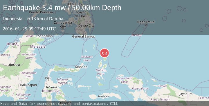
A 5.4 magnitude earthquake struck on NORTH OF HALMAHERA, INDONESIA, at Mon, 25 Jan 2016 09:17:49 GMT. Depth: 50km. Reviewed by EMSC seismologists, this moderate quake occurred at a magnitude type of mw.
Magnitude
5.4
mw
Source
EMSC
Intensity
-
Agency Reports
1 Sources| Source | Magnitude | Depth | Time |
|---|---|---|---|
| EMSCPrimary | 5.4 | 50 km | 10 years ago |
Earthquake Details
AutomaticEvent IDemsc_EMSC_20160125_0000045
Tsunami PotentialNo
Magnitude Typemw
Nearest Places
- Morotai Basin50.5 km
- Tanjung Sopi70.6 km
- Kakaibabao71.5 km
- Tanjung Modiu72.9 km
- Tanjung Padangi73.3 km
Comments
Join the discussion about this event.
Latest Earthquakes
0.9Mag
81 km NNW of Karluk, Alaska
Time4 minutes ago
Depth34.10 km
SourceUSGS (Automatic)
1.5Mag
Tarapaca, Chile
Time13 minutes ago
Depth32.84 km
SourceVYT (Automatic)
2.4Mag
Potosi, Bolivia
Time17 minutes ago
Depth239.01 km
SourceVYT (Automatic)
2.3Mag
Minahassa Peninsula, Sulawesi
Time17 minutes ago
Depth146.04 km
SourceBMKG
1.3Mag
29 km W of Garden City, Texas
Time22 minutes ago
Depth3.35 km
SourceUSGS (Automatic)
Nearby Earthquakes
5.1Mag
NORTH OF HALMAHERA, INDONESIA
Time12 years ago
Depth60.00 km
SourceEMSC (Automatic)
5.3Mag
NORTH OF HALMAHERA, INDONESIA
Time20 years ago
Depth10.00 km
SourceEMSC (Automatic)
5.8Mag
NORTH OF HALMAHERA, INDONESIA
Time20 years ago
Depth33.00 km
SourceEMSC (Automatic)
5.2Mag
NORTH OF HALMAHERA, INDONESIA
Time12 years ago
Depth60.00 km
SourceEMSC (Automatic)
5.1Mag
NORTH OF HALMAHERA, INDONESIA
Time11 years ago
Depth60.00 km
SourceEMSC (Automatic)