Earthquake NORTHERN SUMATRA, INDONESIA
Mon, 13 Feb 2017 20:35:58 GMT
Time9 years ago
Location
3.4400, 98.4500
Depth
10.0 KM
Event Summary
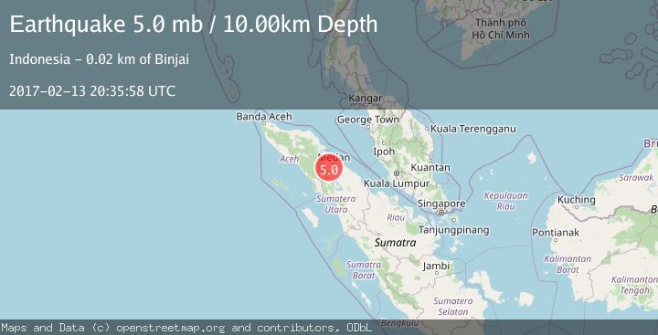
A 5.0 magnitude earthquake struck on NORTHERN SUMATRA, INDONESIA, at Mon, 13 Feb 2017 20:35:58 GMT. Depth: 10km. Reviewed by EMSC seismologists, this moderate quake occurred at a magnitude type of mb.
Magnitude
5.0
mb
Source
EMSC
Intensity
-
Agency Reports
1 Sources| Source | Magnitude | Depth | Time |
|---|---|---|---|
| EMSCPrimary | 5.0 | 10 km | 9 years ago |
Earthquake Details
AutomaticEvent IDemsc_EMSC_20170213_0000147
Tsunami PotentialNo
Magnitude Typemb
Nearest Places
- Laobuluh0.6 km
- Lao Bada0.7 km
- Bangun Mulia1.4 km
- Name Biring1.6 km
- Bandar Kuala1.7 km
Comments
Join the discussion about this event.
Latest Earthquakes
1.7Mag
2 km NW of Enterprise, Nevada
Time7 minutes ago
Depth15.89 km
SourceUSGS (Automatic)
1.3Mag
Southeastern Alaska
Time8 minutes ago
Depth7.20 km
SourceVYT (Automatic)
0.8Mag
39 km NE of Amboy, Washington
Time10 minutes ago
Depth7.36 km
SourceUSGS (Automatic)
3.2Mag
ANDHRA PRADESH, INDIA
Time14 minutes ago
Depth4.70 km
SourceNDI (Automatic)
0.7Mag
10 km WNW of The Geysers, CA
Time16 minutes ago
Depth2.56 km
SourceUSGS (Automatic)
Nearby Earthquakes
5.7Mag
NORTHERN SUMATRA, INDONESIA
Time9 years ago
Depth10.00 km
SourceEMSC (Automatic)
3.0Mag
NORTHERN SUMATRA, INDONESIA
Time3 years ago
Depth10.00 km
SourceDJA (Automatic)
2.6Mag
Northern Sumatra, Indonesia
Time2 weeks ago
Depth105.82 km
SourceBMKG (Automatic)
3.0Mag
NORTHERN SUMATRA, INDONESIA
Time10 months ago
Depth150.00 km
SourceBMKG (Automatic)
5.2Mag
NORTHERN SUMATRA, INDONESIA
Time5 years ago
Depth128.00 km
SourceEMSC (Automatic)