Earthquake SOUTHERN SUMATRA, INDONESIA
Sun, 26 Feb 2017 15:22:01 GMT
Time8 years ago
Location
-4.1500, 102.0500
Depth
60.0 KM
Event Summary
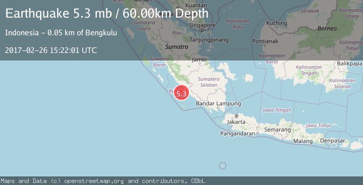
A 5.3 magnitude earthquake struck on SOUTHERN SUMATRA, INDONESIA, at Sun, 26 Feb 2017 15:22:01 GMT. Depth: 60km. Reviewed by EMSC seismologists, this moderate quake occurred at a magnitude type of mb.
Magnitude
5.3
mb
Source
EMSC
Intensity
-
Agency Reports
1 Sources| Source | Magnitude | Depth | Time |
|---|---|---|---|
| EMSCPrimary | 5.3 | 60 km | 8 years ago |
Earthquake Details
AutomaticEvent IDemsc_EMSC_20170226_0000076
Tsunami PotentialNo
Magnitude Typemb
Nearest Places
- Lebar Reef27.8 km
- Kelurahan Teluk Sepang35.2 km
- Pondokkapur35.6 km
- Ujung Teluk Punggur36.1 km
- Air Kungkauunak36.2 km
Comments
Join the discussion about this event.
Latest Earthquakes
1.3Mag
Southern Alaska
Time3 minutes ago
Depth0.00 km
SourceVYT (Automatic)
1.7Mag
Kenai Peninsula, Alaska
Time8 minutes ago
Depth2.08 km
SourceVYT (Automatic)
2.5Mag
FRANCE
Time11 minutes ago
Depth5.00 km
SourceReNaSS (Automatic)
2.5Mag
Central Alaska
Time17 minutes ago
Depth0.00 km
SourceVYT (Automatic)
1.5Mag
42 km SSW of Cantwell, Alaska
Time19 minutes ago
Depth5.10 km
SourceUSGS (Automatic)
Nearby Earthquakes
5.1Mag
SOUTHERN SUMATRA, INDONESIA
Time8 years ago
Depth80.00 km
SourceEMSC (Automatic)
4.0Mag
Southern Sumatra, Indonesia
Time2 weeks ago
Depth32.30 km
SourceBMKG (Automatic)
3.0Mag
SOUTHERN SUMATRA, INDONESIA
Time4 years ago
Depth28.00 km
SourceDJA (Automatic)
3.1Mag
SOUTHERN SUMATRA, INDONESIA
Time1 month ago
Depth40.00 km
SourceBMKG (Automatic)
4.0Mag
SOUTHERN SUMATRA, INDONESIA
Time6 years ago
Depth29.00 km
SourceDJA (Automatic)