Earthquake Southern Sumatra, Indonesia
Thu, 05 Feb 2026 02:16:00 GMT
Time1 hour ago
Location
-4.1745, 102.0216
Depth
32.3 KM
Event Summary
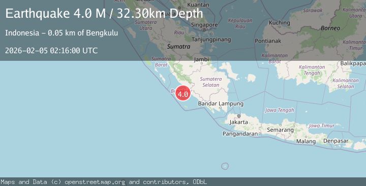
A 4.0 magnitude earthquake struck on Southern Sumatra, Indonesia, at Thu, 05 Feb 2026 02:16:00 GMT. Depth: 32.302425km. Reviewed by BMKG seismologists, this light quake occurred at a magnitude type of M.
Magnitude
4.0
M
Source
BMKG
Intensity
-
Agency Reports
1 Sources| Source | Magnitude | Depth | Time |
|---|---|---|---|
| BMKGPrimary | 4.0 | 32 km | 1 hour ago |
Earthquake Details
AutomaticEvent IDbmg2026cmdc
Tsunami PotentialNo
Magnitude TypeM
Nearest Places
- Lebar Reef31.9 km
- Kelurahan Teluk Sepang39.3 km
- Pondokkapur39.8 km
- Air Kungkauunak40.2 km
- Ujung Teluk Punggur40.3 km
Comments
Join the discussion about this event.
Latest Earthquakes
2.0Mag
Sulawesi, Indonesia
Time1 hour ago
Depth5.00 km
SourceBMKG (Automatic)
2.9Mag
WESTERN TEXAS
Time1 hour ago
Depth7.30 km
SourceTX (Automatic)
2.6Mag
32 km SE of Cantwell, Alaska
Time1 hour ago
Depth74.90 km
SourceUSGS (Automatic)
2.0Mag
Bali Sea
Time1 hour ago
Depth10.00 km
SourceBMKG (Automatic)
2.3Mag
57 km NE of Chenega, Alaska
Time1 hour ago
Depth19.80 km
SourceUSGS (Automatic)
Nearby Earthquakes
3.2Mag
Southern Sumatra, Indonesia
Time6 days ago
Depth23.74 km
SourceBMKG (Automatic)
3.2Mag
Southern Sumatra, Indonesia
Time1 week ago
Depth10.00 km
SourceBMKG (Automatic)
3.6Mag
Southern Sumatra, Indonesia
Time1 week ago
Depth72.51 km
SourceBMKG (Automatic)
3.2Mag
Southern Sumatra, Indonesia
Time2 weeks ago
Depth48.75 km
SourceBMKG (Automatic)
3.2Mag
Southern Sumatra, Indonesia
Time5 hours ago
Depth25.26 km
SourceBMKG (Automatic)